Go to the main content section Anchor point

New Taipei City Travel

Pingxi Sky Lantern Festival Brightens up Beautiful Sky in New Taipei City

Anchor point
In the night of Lantern Festival, sky lanterns slowly fly upward, carrying people’s wishes into the night sky. The beautiful scene can be seen at the most representative festival in New Taipei City. Since 1999, New Taipei City government has held Sky Lantern Festival in Pingxi on Lantern Festival that falls on January 15 of the lunar calendar, and it is the grandest annual festival of the mountain town of Pingxi. For over twenty years, numerous tourists from home and abroad have attended the festival to light up sky lanterns, flying them into the night sky with their dreams and wishes.
2024平溪天燈節


Multiple Origins of Sky Lanterns
“Please help us!” During the Three-Kingdom Period, Zhuge Kongming (Zhuge Liang), the prime minister of Empire of Shu-Han, sent large paper lanterns up to the sky to deliver military messages by following the principle of rise of hot air when he and his soldiers were besieged by the enemy, and they eventually got out of the predicament. This the most well-known origin of the sky lantern, so it is also known as Kongming lantern. Others think the sky lantern gets the name of Kongming lantern because it shapes like the silk ribbon scarf of Kongming. Like Internet and other inventions, the sky lantern originated from military technology. The sky lantern has been considered the originator of the hot-air balloon, and the threshold of humans’ flying dream. The sky lantern first appeared in the battlefield in Europe when Mongolia went on an expedition to the west. Five hundred years later, the first hot-air balloon carrying passengers rose to the sky in Paris.
平溪天燈節

Praying for Blessings at Lantern Festival  
After sky lanterns go about among people, the release of sky lanterns has become a folk activity for people to pray for blessings. Since ancient times, there has been the custom of releasing sky lanterns at Lantern Festival which is the birthday of Heavenly Lord Tian Guan, and the sky lantern is a medium for people to pray for blessings to the God. Pingxi District, New Taipei City is located at the upper reaches of Keelung River. In the beginning of the 19th century, immigrants from Fujian were harassed by bandits from time to time when they reclaimed Pingxi, and sky lanterns were used as tools to mark themselves safe. In the 1990s, Pingxi started the revival movement for sky lantern culture, attracting tourists to release sky lanterns in the mountain town. The activity has become the most famous one in Pingxi. Moreover, with the help of popular movies, Pingxi sky lanterns have become well-known around the world.
2024平溪天燈節
2024平溪天燈節

Unique Climate and Terrain of Pingxi
When it comes to sky lanterns, people think of Pingxi. However, why is Pingxi so closely related to sky lanterns? In accordance with current laws and regulations, Pingxi is the only area in Taiwan where sky lanterns can be released outside. Pingxi is one of the areas in Taiwan with the most rainy days, and it has a relative humidity of over 75% often. Damp environment prevents sky lanterns from wreaking havoc after they fall to the ground. Additionally, Pingxi is surrounded by mountains on four sides, and there is no airport nearby, which ensures that sky lanterns only fly in the mountainous area of Pingxi without disturbing flights, making Pingxi the best location to release sky lanterns.
平溪線鐵道

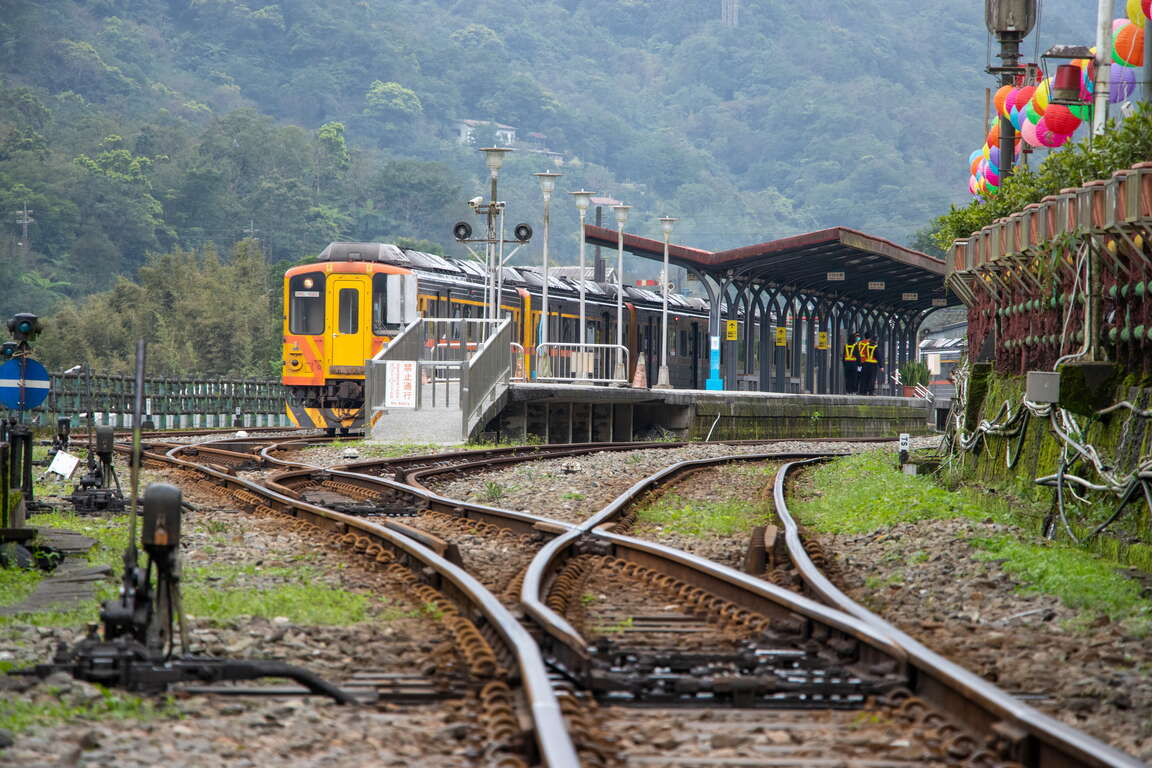
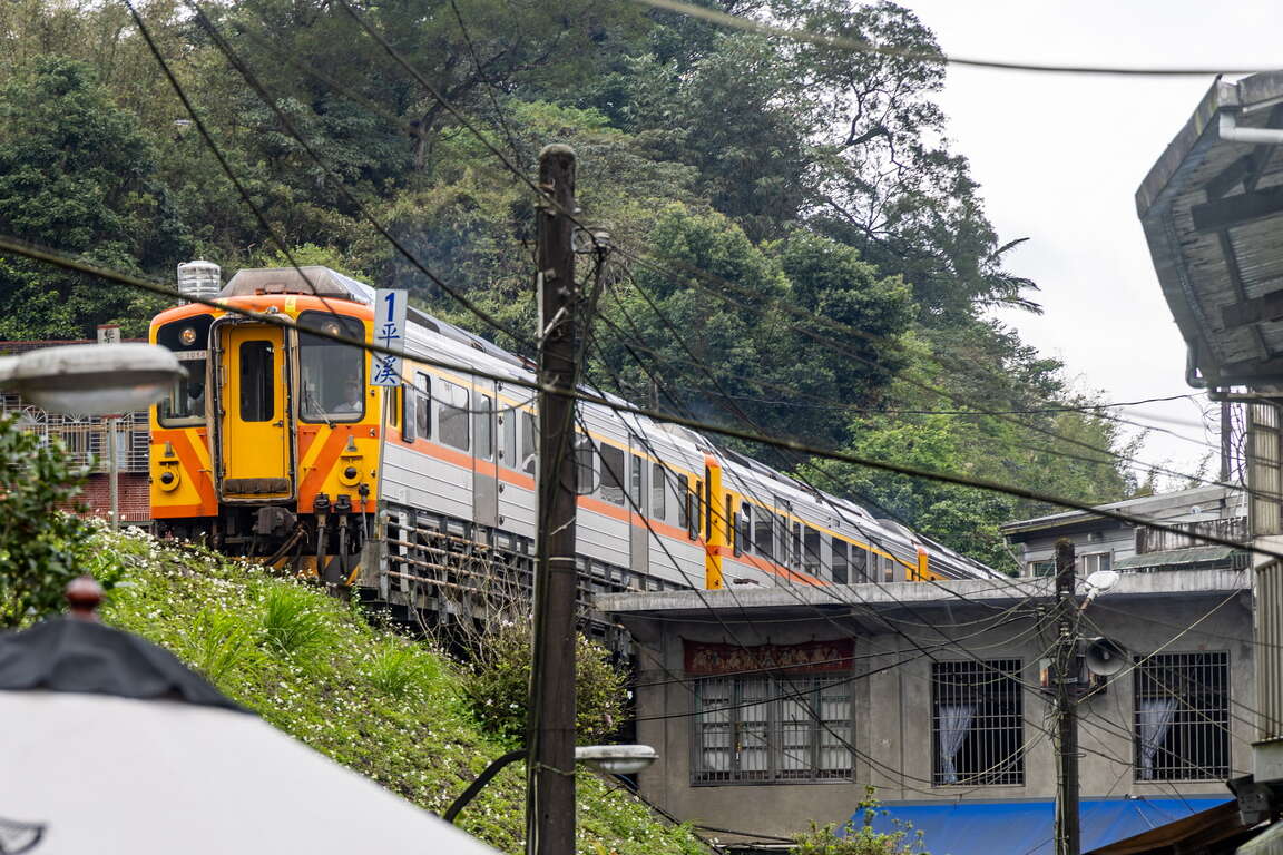
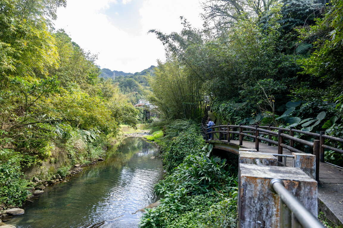
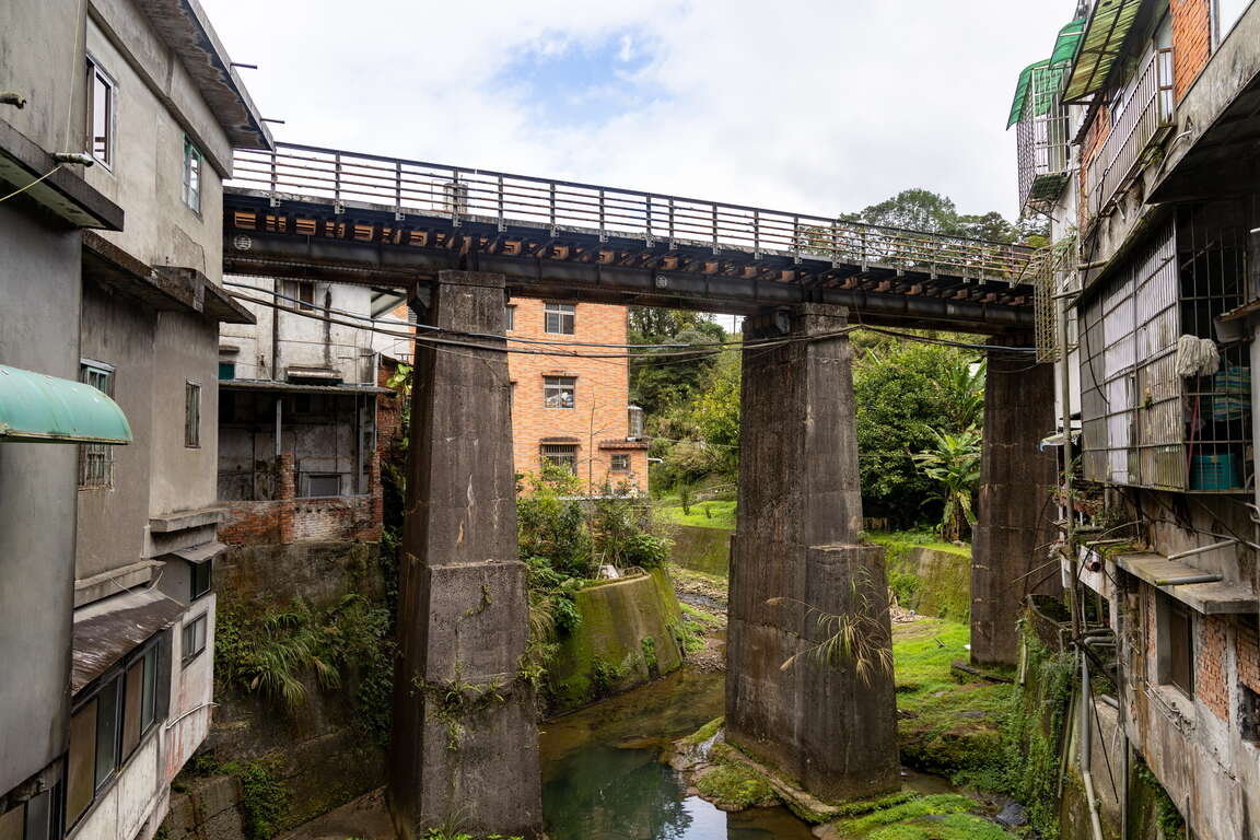
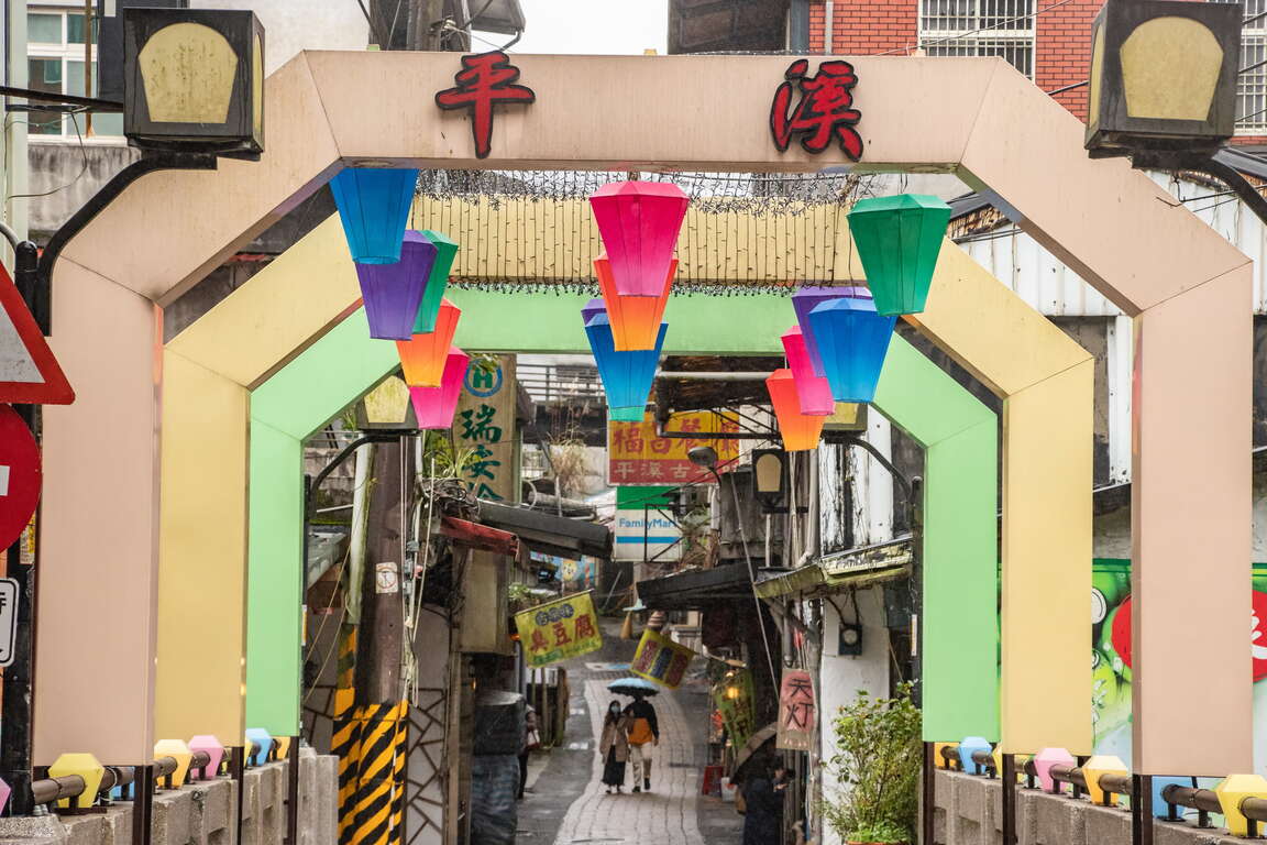
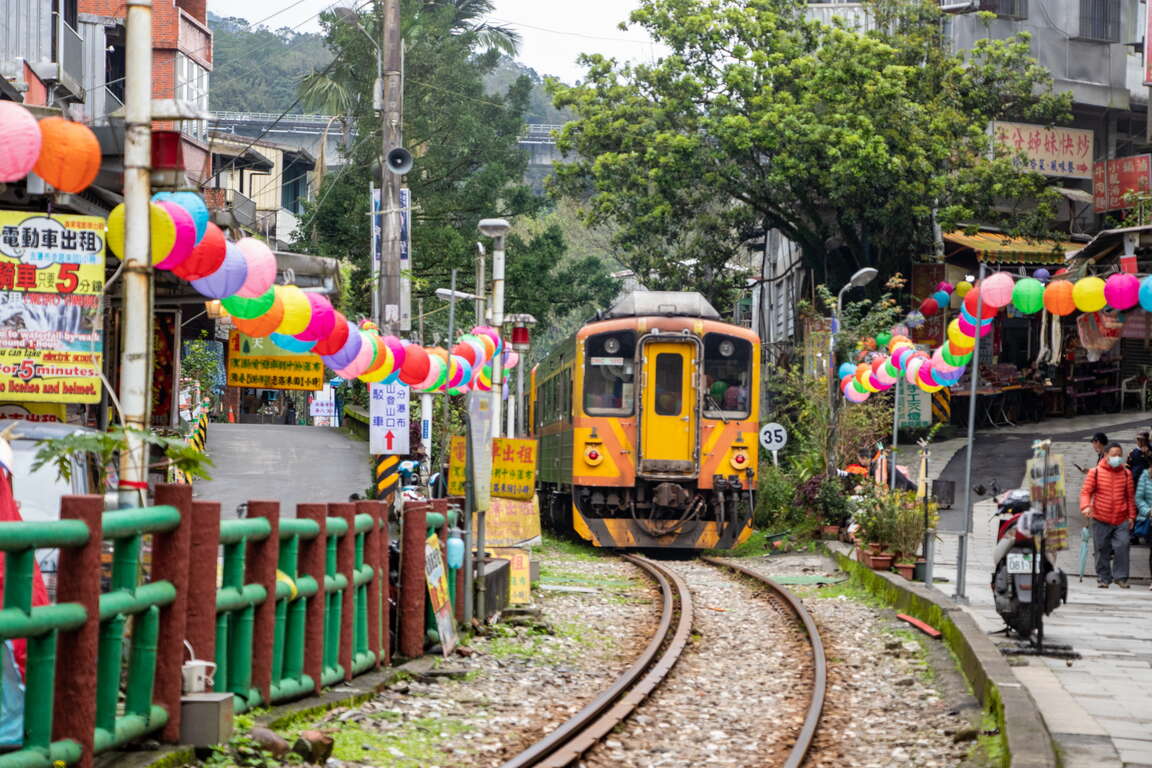
Pingxi District is a district in New Taipei City with least population. It was the settlement of the Ketagalan tribe. In the early 19th century, the Han people reclaimed Pingxi, and it became prosperous because of coal mining in the early 20th century. However, it became quiet again after mining ceased. The Pingxi Railway which was open to traffic in 1921 was once doomed to dismantle. Thanks to the endeavors of local people, the railway has turned into a sightseeing railway. The one-hundred-year Pingxi Railway passes by charming railway towns, such as Shifen, Pingxi and Jingtong, where you can find magnificent Shifen Waterfalls, and secluded stations rarely known to anyone. Light Pingxi tours are promoted every year during Sky Lantern Festival, and local tour guides would lead tourists to explore mining culture and railways, relishing the beauty of the mountain town.
平溪小旅行
平溪線鐵道

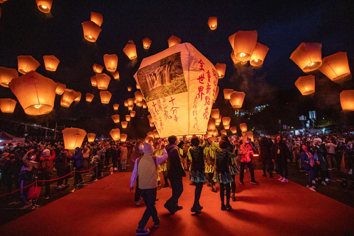
New Taipei City Pingxi Sky Lantern Festival
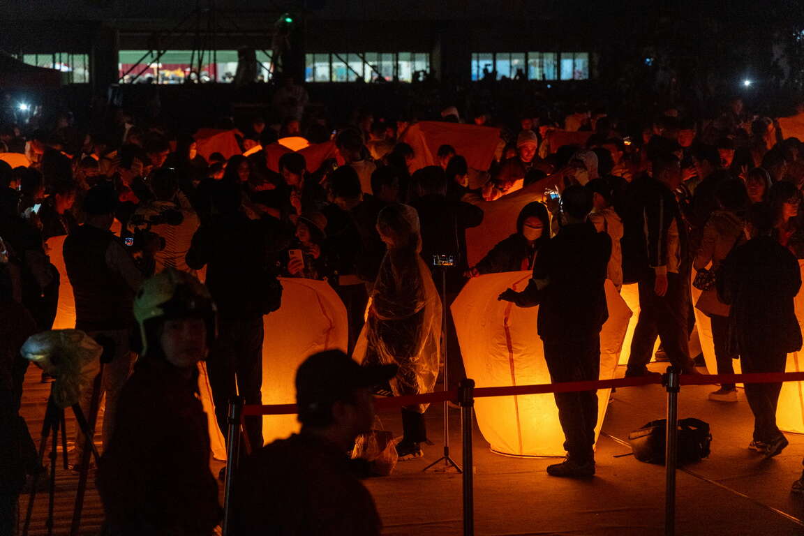
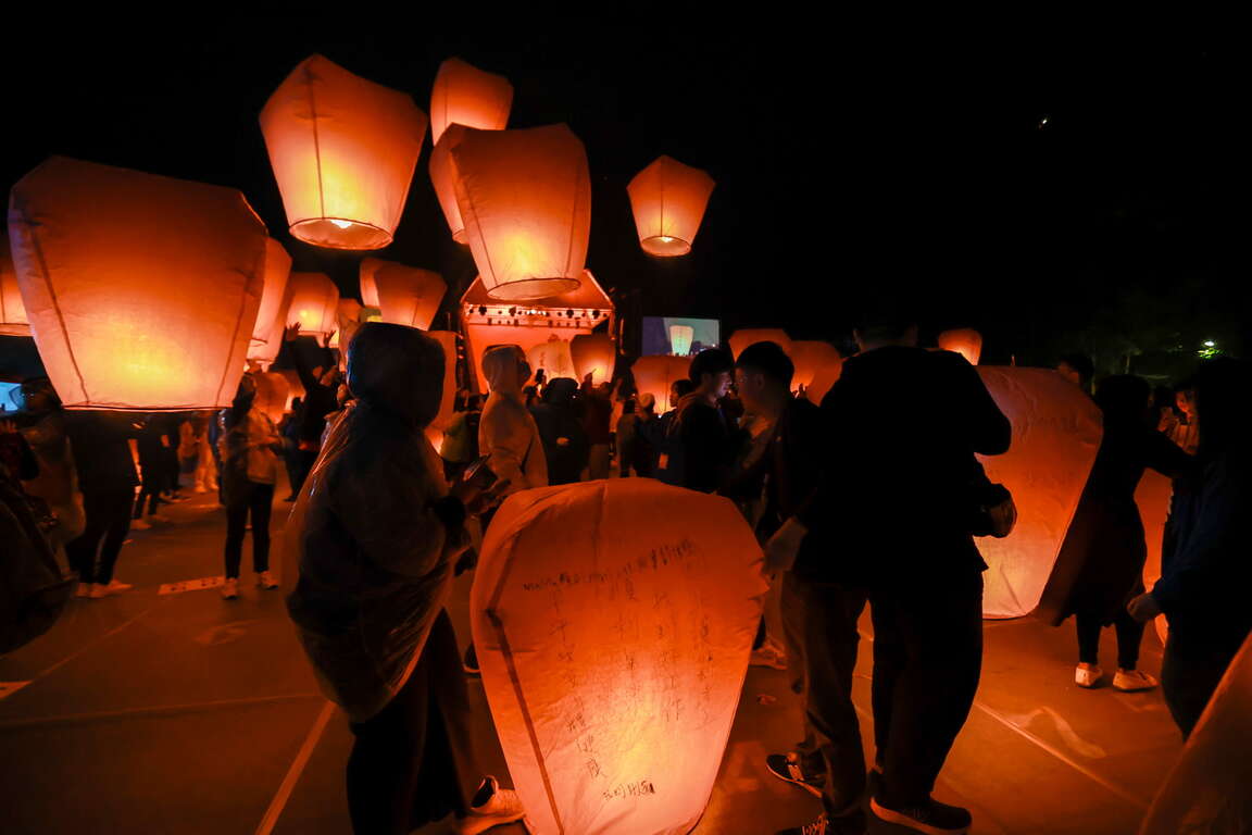
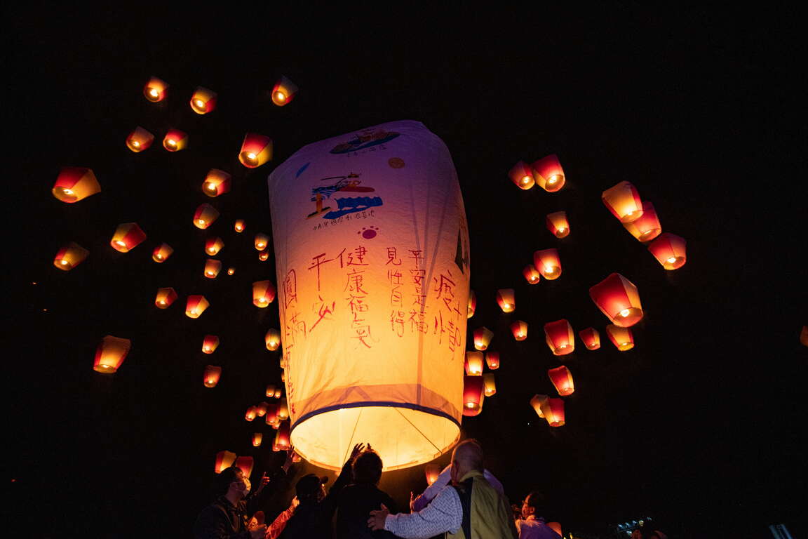
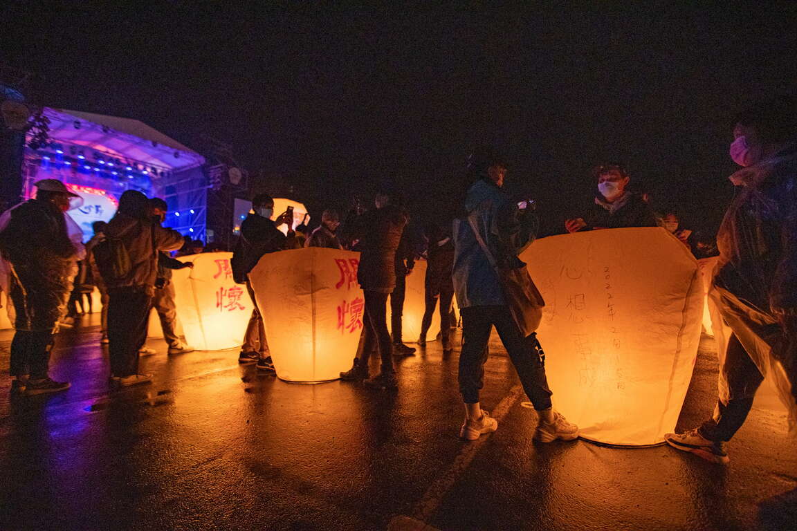
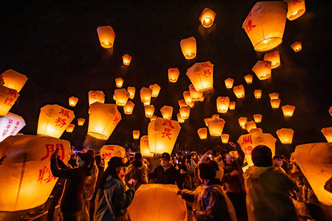
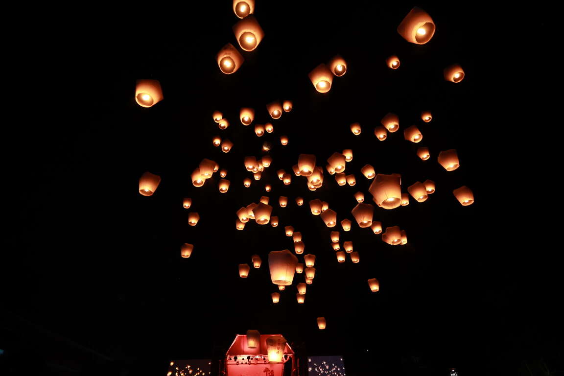
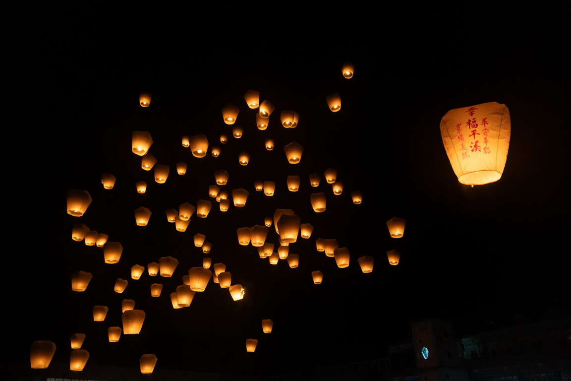
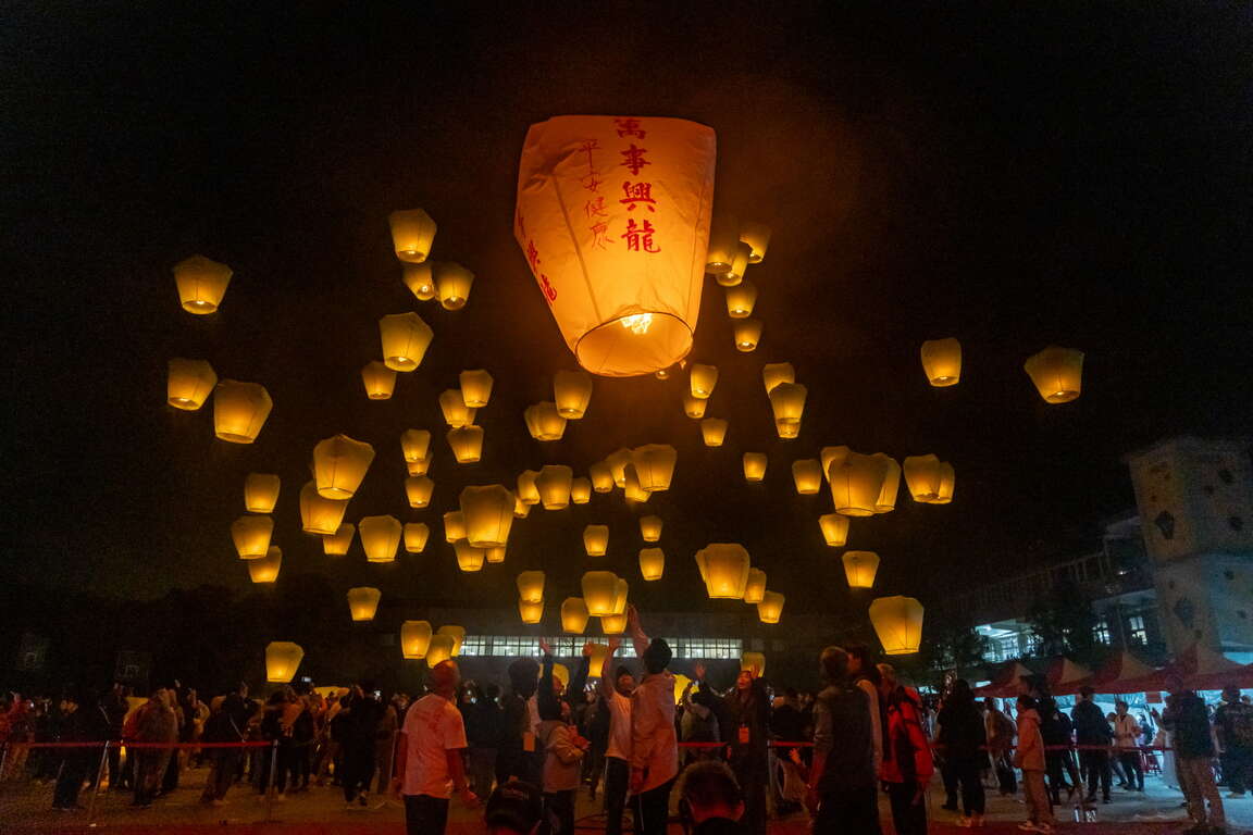
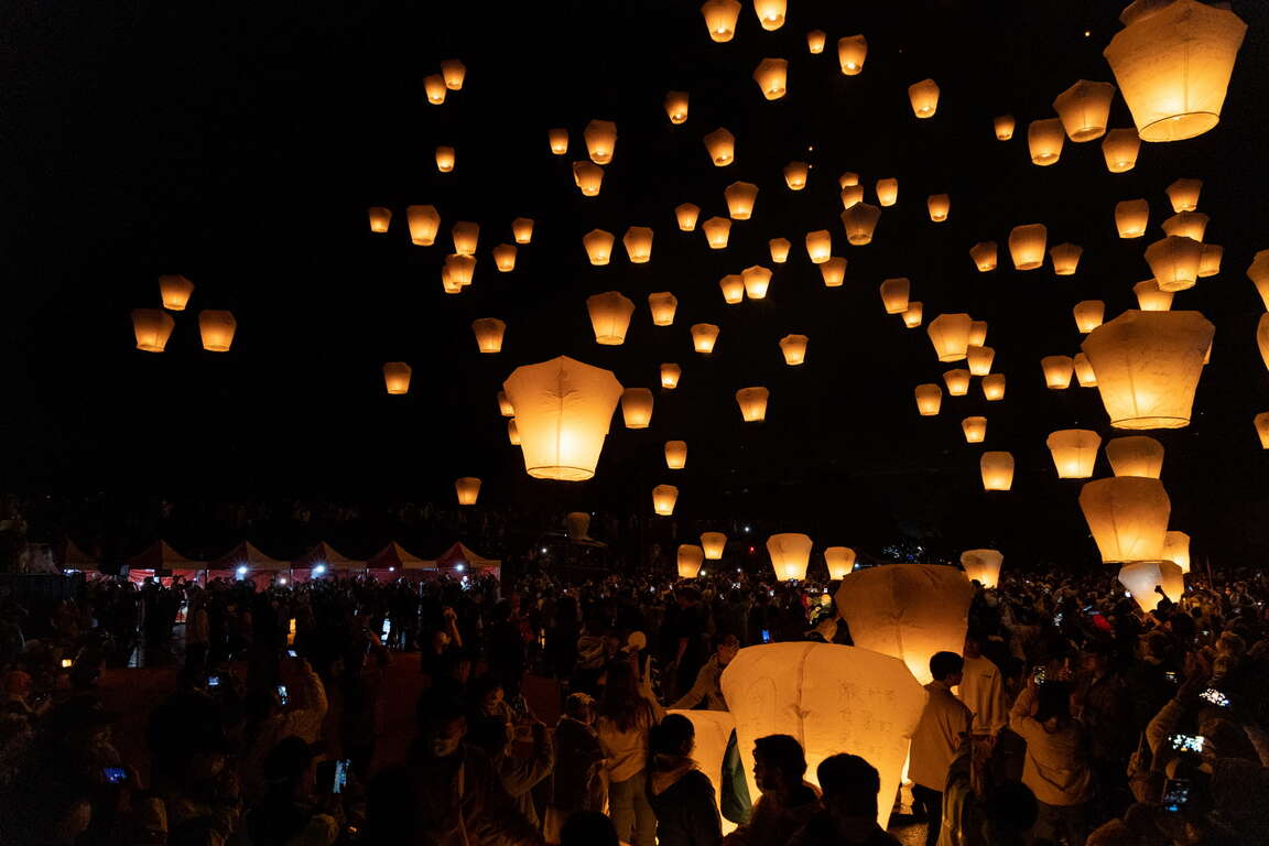
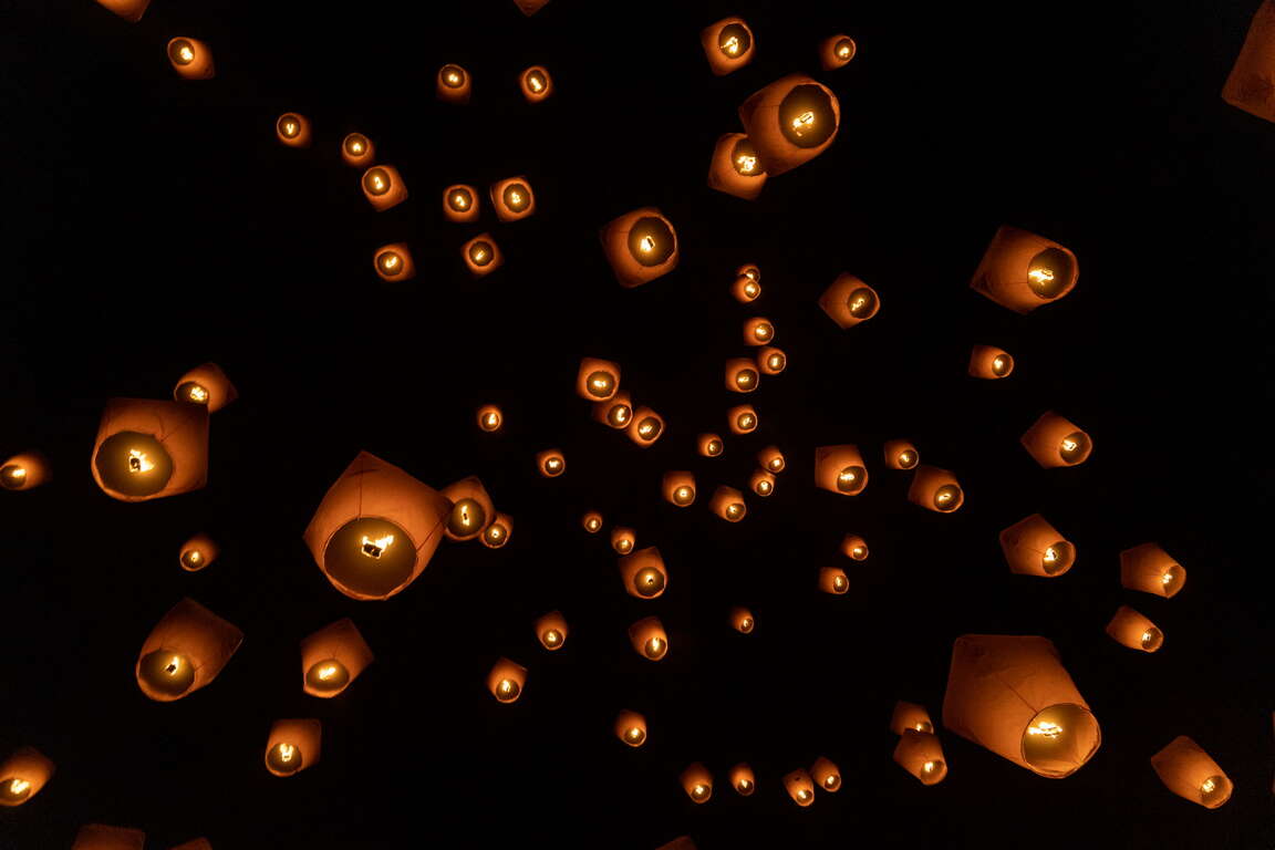
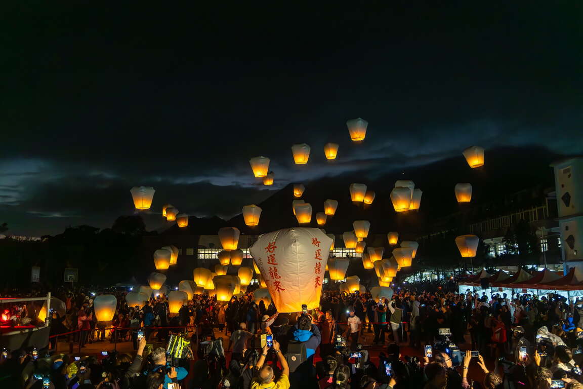
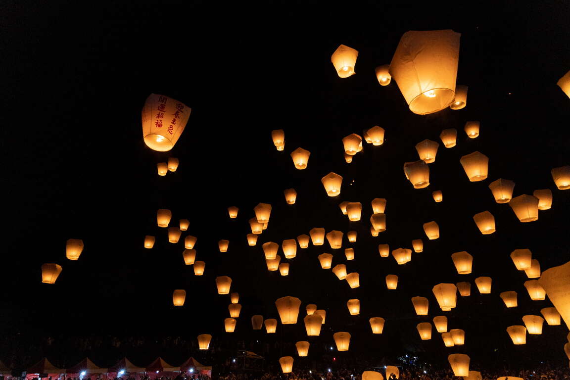
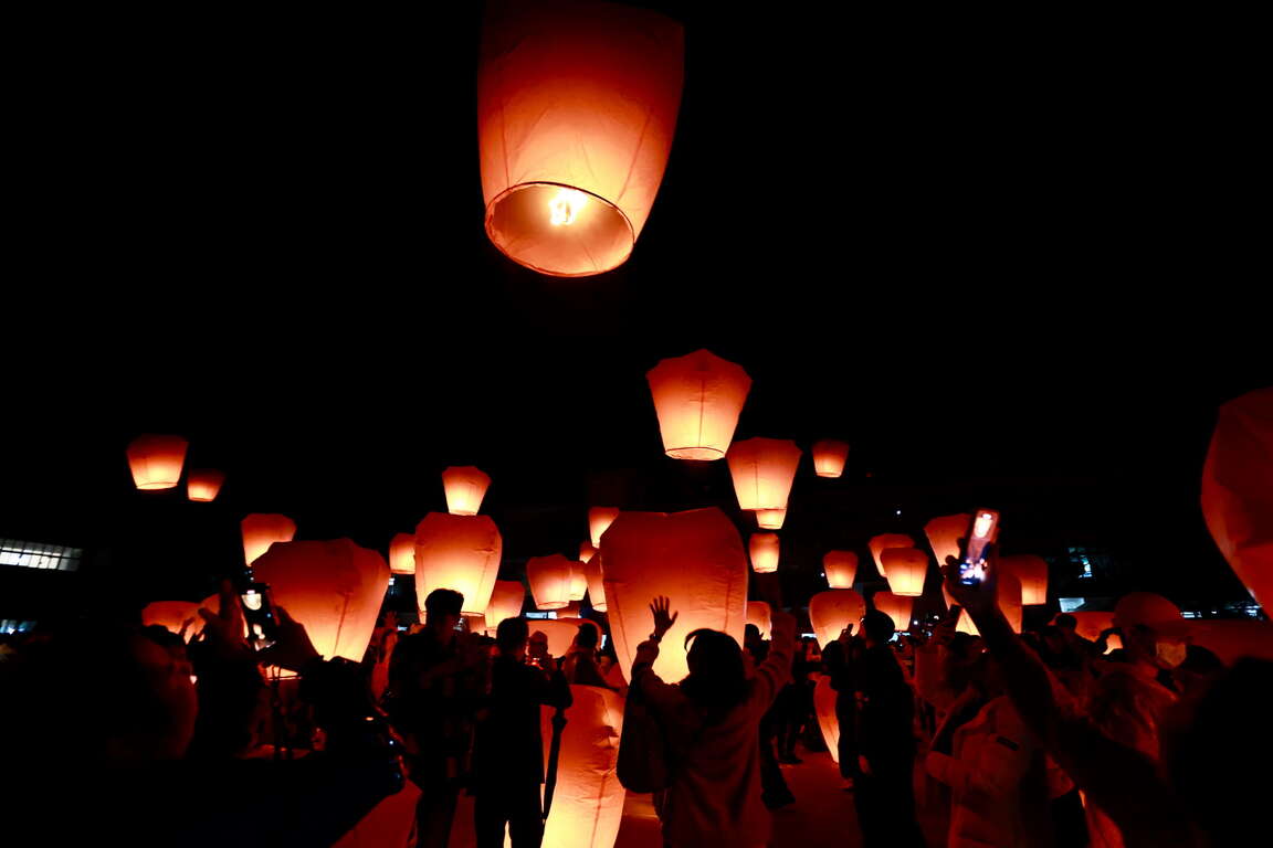
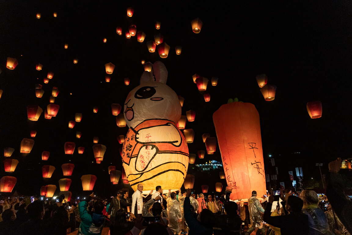
New Taipei City government held the first Pingxi Sky Lantern Festival in 1999, and this year marks the 26th anniversary of the event. It is the most famous ceremony for Lantern Festival in northern Taiwan. The Sky Lantern Festival enjoys the fame with the beehive fireworks in Yanshui, Tainan as we always say “sky lanterns in the north, and beehive fireworks in the south.” The two festivals have repeatedly been selected the must-see festivals by travel websites. Two sessions of releasing sky lanterns are held each year at Pingxi Sky Lantern Festival, which are on the day of Lantern Festival and one weekend before the festival. Quiet a few sky lanterns are allowed to be released each time in each section. When over one hundred sky lanterns are released at the same time, the dreamlike scene brightens up the night sky of the mountain town of Pingxi.
👉Official website of 2024 Pingxi Sky Lantern Festival
2022平溪天燈節
2024平溪天燈節

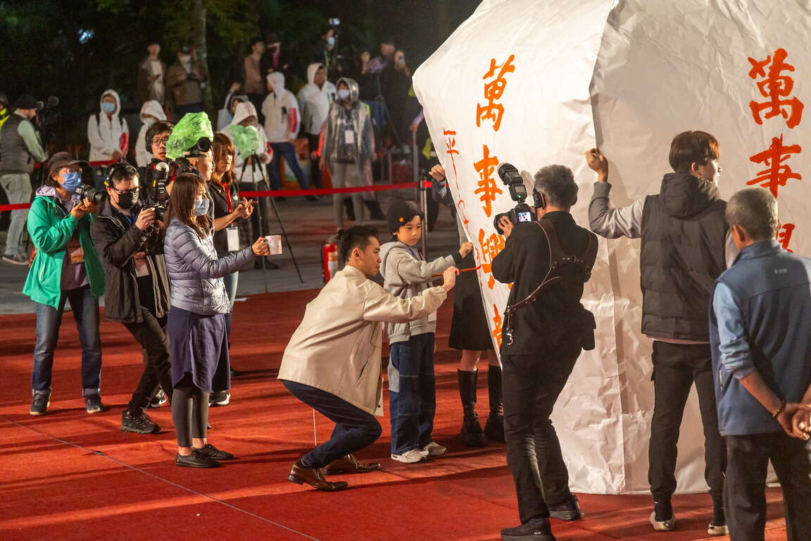
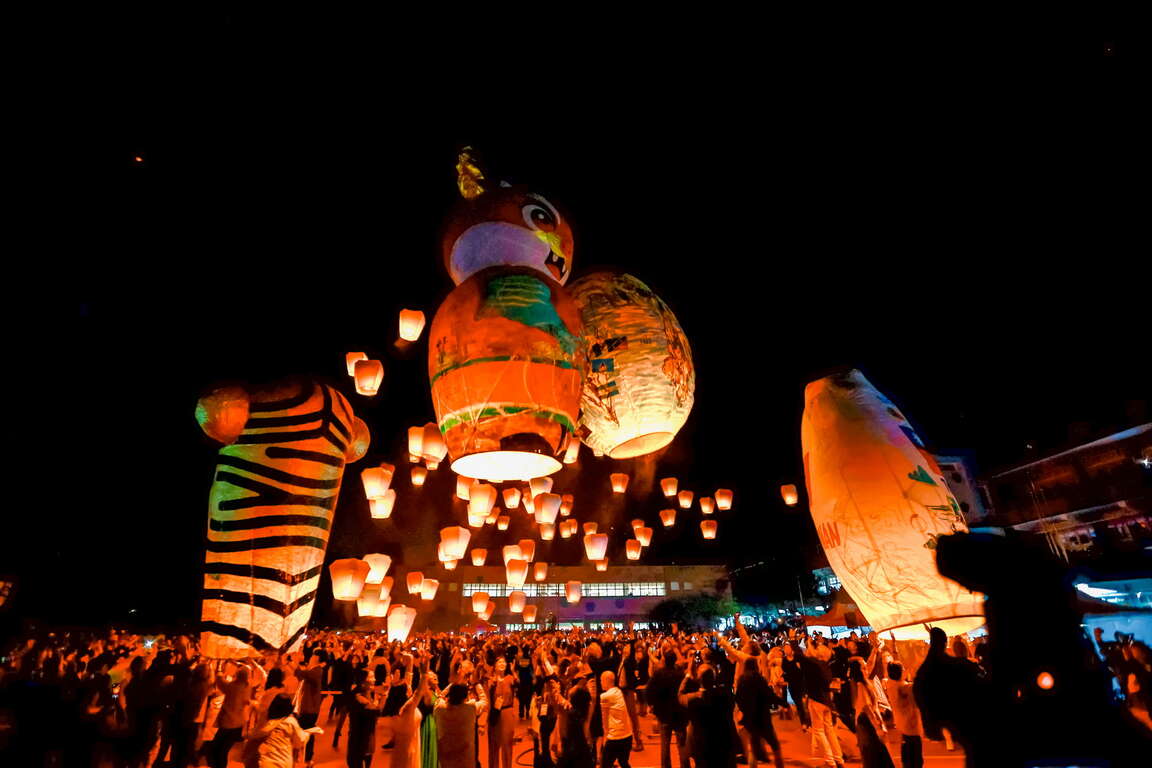
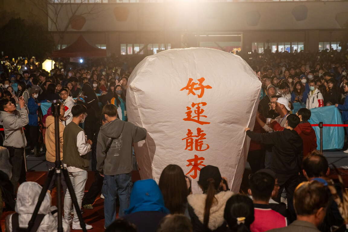
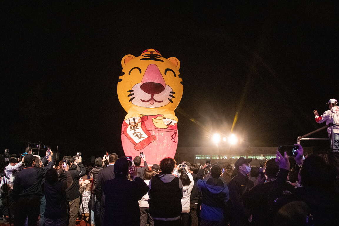
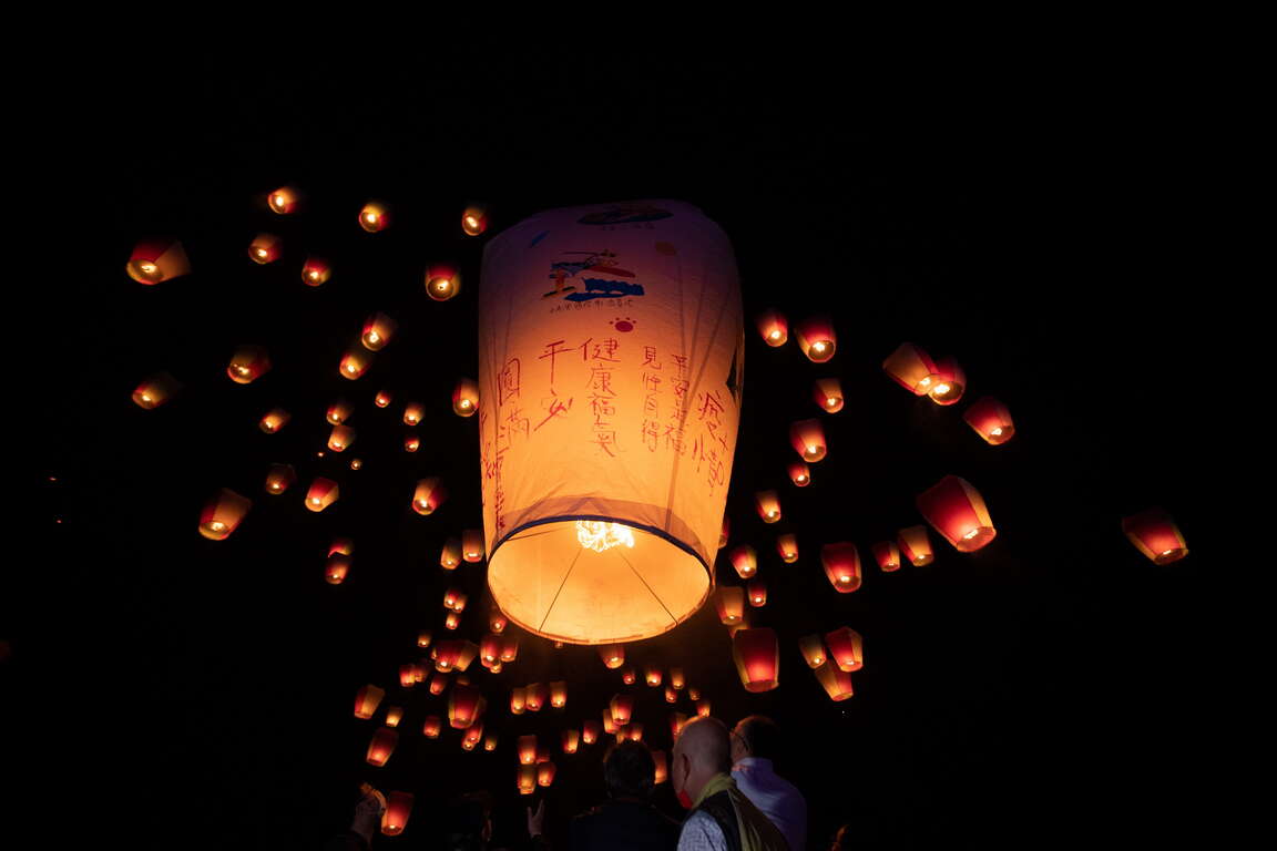
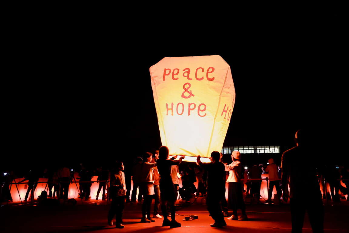
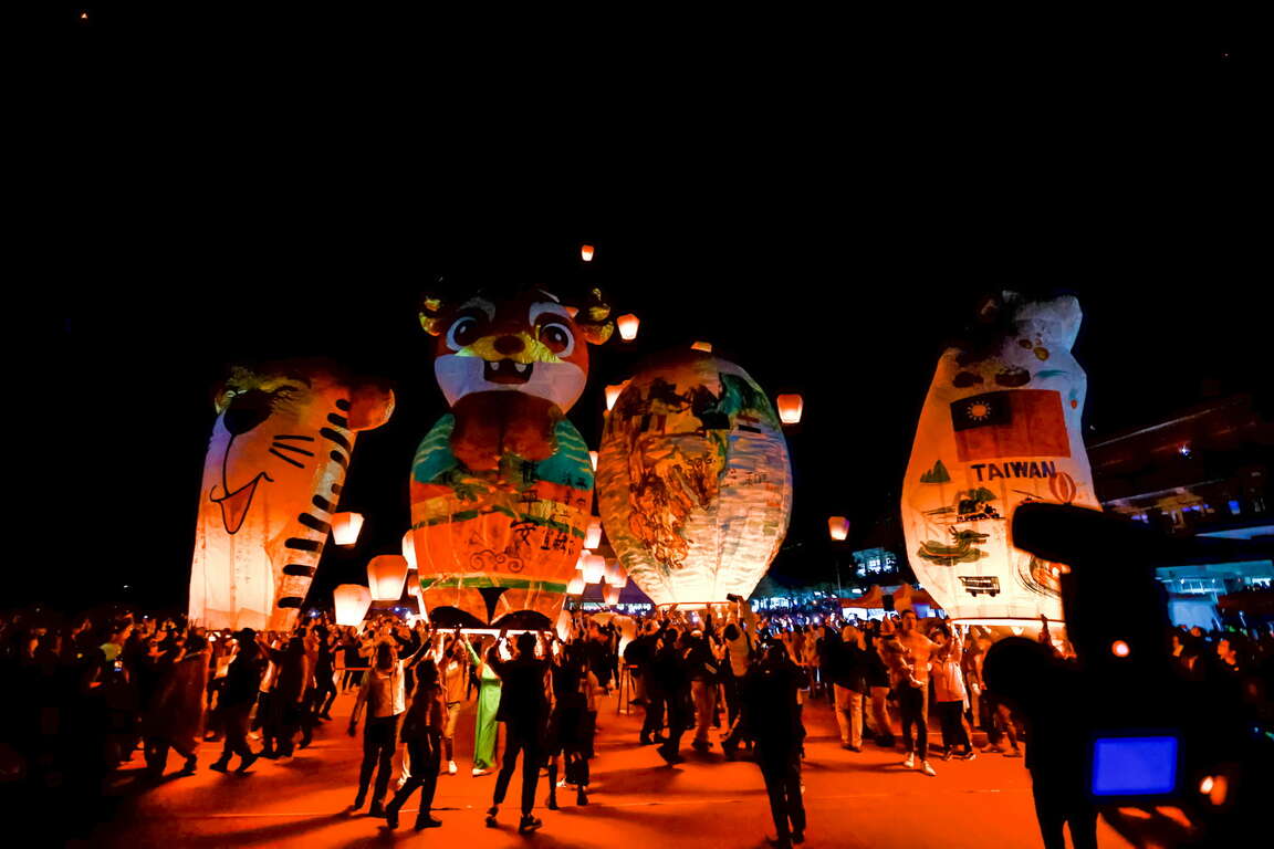
Sky Lantern Festival each year features the Chinese zodiac sign of that year. The main lantern that is up to 20 feet tall presents excellent sky lantern making craftsmanship. One can write on the sky lantern made with rice paper with a Chinese writing brush. After that, you put paper money inside the lantern as fuel to push it up to the sky.
2024平溪天燈節
2023平溪天燈節

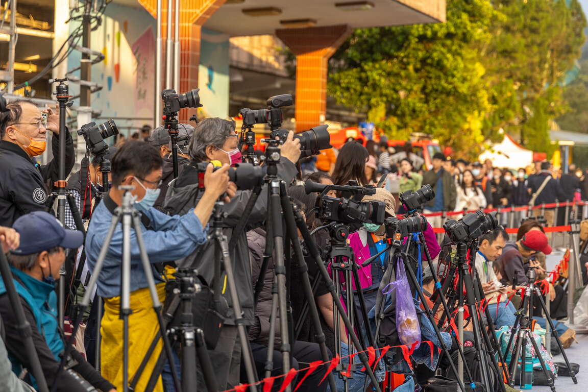
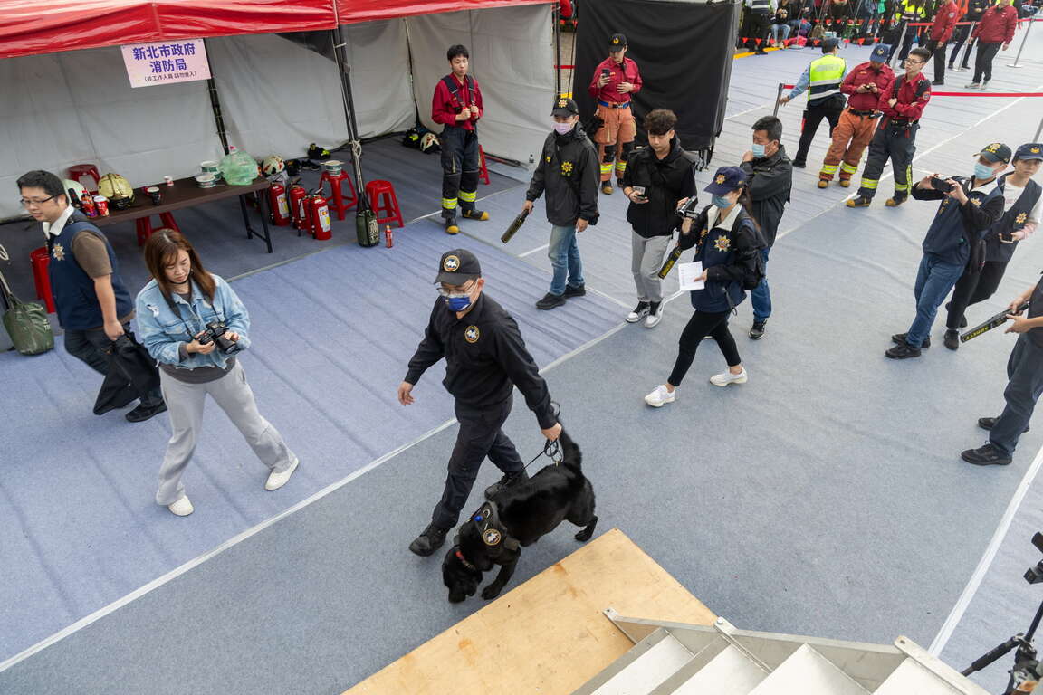
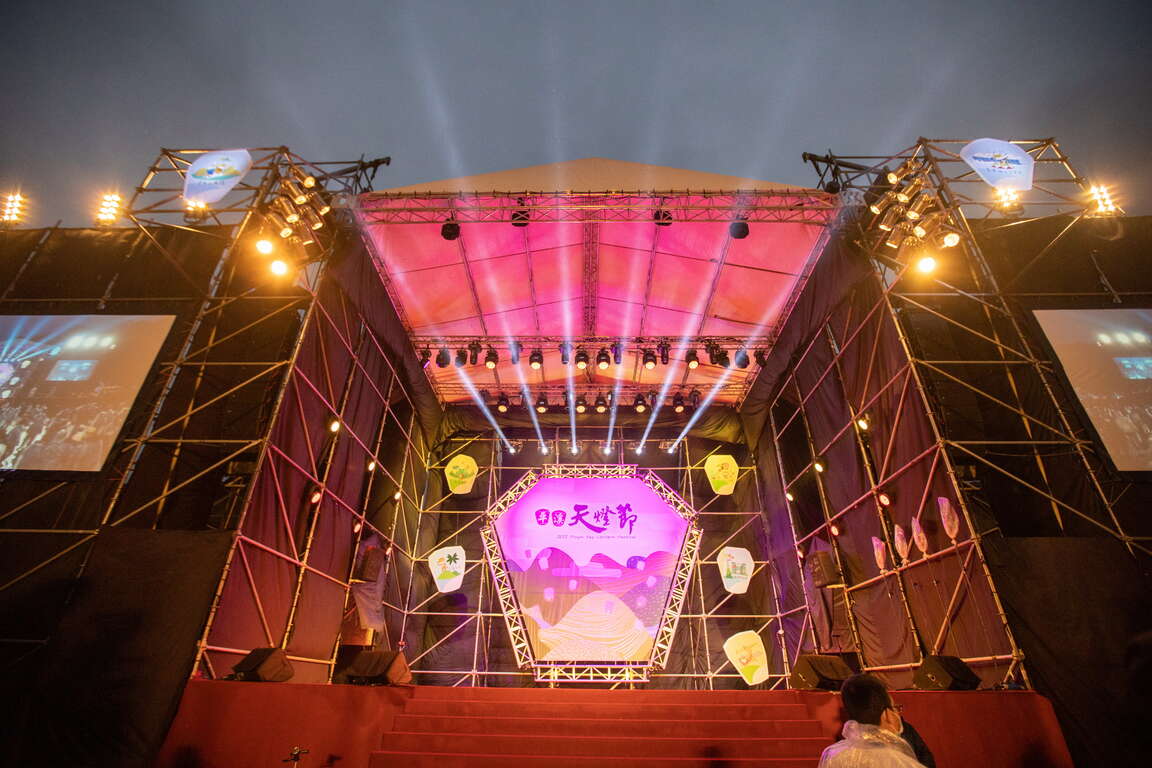
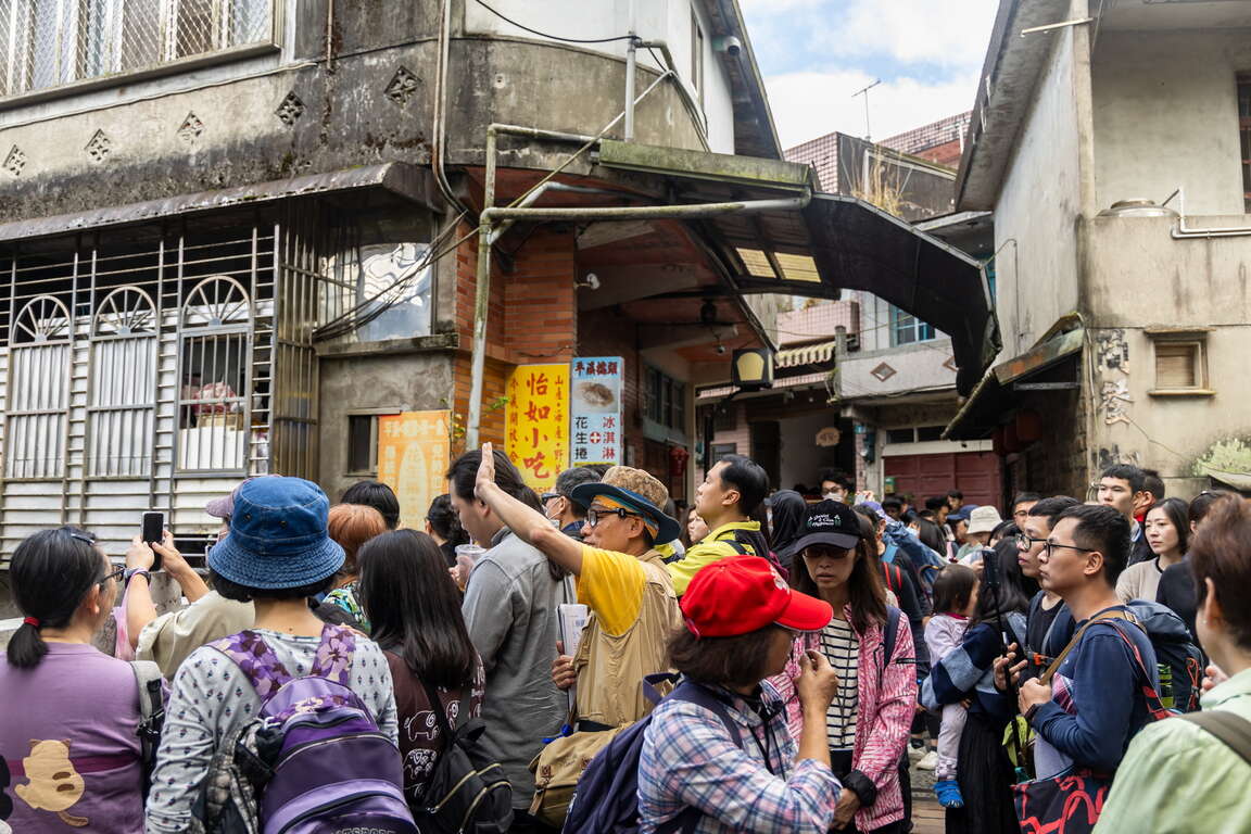
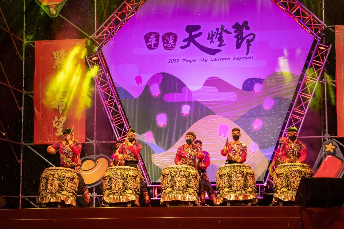
Sky Lantern Festival is the most important event in Pingxi District. Residents, public servants, schools and stores will all devote themselves to the grand occasion by participating in performances and planning fairs. To deal with a great number of tourists, New Taipei City government deploys police and firefighters to maintain the safety of participants, enabling them to enjoy the pleasure of releasing sky lanterns.
2022平溪天燈節
安全至上

Mountain Cleanup to Protect Environment
Sky lanterns carrying blessings and wishes will eventually fall to the ground in the distance after they disappear from sight. To maintain the environment of Pingxi, New Taipei City government holds a mountain cleanup activity and cultural tour after Sky Lantern Festival every year to enable participants to help collect sky lanterns and listen to instructors tirelessly telling stories about Pingxi at the same time.
2024平溪天燈節
2024平溪天燈節
Previous
The Must-see Attraction for Foreign Visitors- the Yehliu Geopark
You only have a week in Taiwan and do not want to spend too much transportation time? Then you definitely cannot miss the "world-famous" tourist attraction- the Yehliu Geopark. I assume you have done your research on the must-see attraction that people are talking about before coming to Taiwan. Have you heard of the "alien planet" in the northern Taiwan? If no, please add it to your travel to-do-list. The Yehliu Geopark is located in the suburban area of Taipei City. It is 40 minutes away from downtown by public transportation. The long and narrow capes sticking out from the island are eroded by the strong northeast monsoon, and with the weathering and coastal erosion, the "Mars landscape" is thus generated. There are lots of rock types here and you can even see gradient colors on some of the rocks. The famous rocks will be introduced below. You will definitely be amazed when seeing the art of nature in person!Pedestal rock area/ wave-cut platform- 2 main characteristics of the GeoparkIn the first area, you will see lots of pedestal rocks, ginger shaped rocks and candle shaped rocks. When looking around, pedestal rocks are everywhere. With time passing by, the hard concretion inside the sandstone is exposed, and with the effect of wind, sun, rain, wave as well as the erosion of the northeast monsoon, the pedestal rocks of different shapes, such as the pedestal rocks with no necks, bulk necks, narrow necks and broken necks, are thus formed. The landscape with lots of pedestal rocks is very uneven, so pay attention while you are walking on it. Do not be too focused on taking photos or enjoying the view and fall.The second area on the other side of the Geopark has the wave-cut landscape. You will find sea caves, coastal notches, wave-cut platform and cuesta. On one side of the wave-cut platform is the cliff and on the other side is the rapid wave. You will find lots of interesting rocks eroded by the seawater here, including the Twenty-four Filial Exemplars Rocks.Landscape Wonder- The Pedestal RocksWhen first walking into the Geopark, you will see a huge area of the pedestal rocks. When seeing afar, it's like the cute mushrooms park. And the pedestal rocks are the landscape that attracts most people in the Yehliu Geopark. The process for the formulation of the pedestal rock is first the rock formation exposed from the sea surface, and the seawater will erode the rock continuously. After some time, the hard concretion inside the sandstone is exposed, and with the effect of wind, sun, rain, wave as well as the erosion of the northeast monsoon, the pedestal rocks of different shapes, such as the pedestal rocks with no necks, bulk necks, narrow necks and broken necks, are thus formed. The different shapes of the rocks represent the different formation processes. The landscape with lots of pedestal rocks is very uneven, so pay attention while you are walking on it. Do not be too focused on taking photos or enjoying the view and fall.The Star of the Geopark - "Queen's Head"The next coming up is the star of the Yehliu Geopark, "Queen's Head". The Queen's Head is a kind of pedestal rock. When the crustal structure was rising, the differential erosion of the seawater made the Queen's Head what it is like today. If we divide its height by the average crust rising speed in northern Taiwan, we will learn the Queen's Head is about 4,000 years old. The Queen's Head is a kind of pedestal rock. However, the joint on its upper concretion broke during 1962-1963. When viewing from a certain angle, it looks similar to the head portrait of Elizabeth II and thus acquires the name. With the natural weathering effect over the decades, the neck of the Queen's Head is getting even narrower. To prevent erosion by human activities for that tourists might touch it, the Queen's Head is now under protection. If you would like to take a photo with the Queen's Head, you can walk on the wooden plank trail to line up. Besides, you can view the Queen's Head from afar and take photos with it on the trail.The "Cute Princess Rock" and "Candle Shaped Rock" are the popular landscape at the Geopark. The formation process of the "Cute Princess Rock" is similar to that of the Queen's Head. The eroded rock looks like a princess with a ponytail and is said to be the potential replacement of the Queen's Head. Doesn't the rock look like a little girl with her hair in a bun? Though the Cute Princess Rock is probably not as element and sophisticated as the Queen's Head, it gives people a feeling of passion and sweetness.How was the "Candle Shaped Rock" named? I guess you already know! The landscape looks just like candles. There are 3 main processes for the formation of the Candle Shaped Rock. First the candle fire is exposed, and the area around it is eroded to form a groove. Finally, the candlestick is cut and the Candle Shaped Rock is thus formed. The candle fire is actually a round concretion in the rock formation. When seawater erodes sandstone, the round concretion which is harder is exposed on the ground. And when waves dash against the concretion, seawater flow around the concretion to erode the sandstone around it. A groove is formed as a result. Since the formation outside the concretion is harder, seawater will flow according to the shape of the formation and cut the rock into a cone shape that looks like a candlestick. And a rock that looks like the shape of candle is formed by mother nature.Amazing Rocks- CuestaNow let's look at the beautiful scene of the Cuesta in the second area. Walking along on the road to the Cuesta, you will see the most beautiful sea and mountain scene in the Geopark. You can view the Cuesta on one side and the sea cliff as well as wave-cut platform on the other side.The Cuesta features a sharp cliff on one side and a smooth slope on the other side. It is formed because the main stratum is pushed by uneven force and speed, which results in uneven rise of the stratum. When the stratum is pushed, the lump on the ground will cause the stratum to break. And after the seawater erosion, a landscape that looks like a "natural slide" is gradually formed.Guess how famous is the Yehliu Geopark? CNN once reported that the scene at the "Yehliu Geopark" is like the landscape in the outer space and that it has the environment that looks just like the one Mars has. You will definitely find lots of gorgeous and special rocks, including the "Queen's Head", "Ice Cream Rocks", "Beehive Rocks", "Ginger Shaped Rocks" and other wave-cut landscape. You will definitely be amazed by the diverse geologic structure and landscapes here. What's more, you can see how great and powerful nature is. Whether it's from the perspective of geographic environment or location and transportation, the Geopark is definitely worth visiting!Transportation Information of the Yehliu Geopark*Tamsui Bus No.862 (Take the bus heading to Keelung in front of MRT Tamsui Station and get off at Yehliu.) The bus sets out every 30 minutes.*KUO-KUANG eBus No. 1815 (Take the bus heading to Chinshan Youth Activity Center at the KUO-KUANG eBus Station at Taipei Main Station. The Bus drives along Zhongxiao E. Road and makes a brief stop at the Taipei City Hall Bus Station. Please get off at Yehliu.) The bus sets out every 20 minutes.*Keelung Bus No.790 (Take the bus heading to Jinshan next to Keelung Train Station and get off at Yehliu.) The bus sets out every 15 minutes.*Keelung Bus No.1068 (Take the bus heading to Jinshan at National Taiwan University and get off at Yehliu Geopark.)*Keelung Bus No.953 (Take the bus heading to Jinshan at the bus station next to Banqiao Train Station and get off at Yehliu Geopark.)Nearby Places to Go Jinshan Wanli Cycling Route-->Jinshan Wanli Hot Spring
Next
Tamsui-Kavalan Trails: Hand-made trails, documentaries, and books
The Tamsui-Kavalan Trails were an important mountain trail network that spanned across the Taipei Basin and Lanyang Plain during the Qing Dynasty. They played a crucial role in transportation between these two points before the TRA launched the Yilan Line. The Tamsui-Kavalan Trails should not be regarded simply as a “route” connecting Tamsui Subprefecture and Kavalan Subprefecture. Instead, over the past 200 years or so, the northern section of Xueshan (Xue Mountain) has held invaluable historical memories, including indigenous hunting paths, the footprints of Han people, trading posts, and military patrols. Countless ancestors traversed these dozens of intricate and meandering mountain paths. The Tamsui-Kavalan Trails also bore witness to the development of Taipei City, New Taipei City, Keelung, and Yilan, and can be regarded as Taiwan's pilgrimage route. Today, it has been designated as a “National-Level Green Trail”.2015 and 2016 – “Reappearing the Centuries-Old Tamsui-Kavalan Trails”After the advent of railways and national freeways, the entire world underwent a significant transportation revolution. The Tamsui-Kavalan Trails, which had lost their original transportation function, gradually faded from public view. Nevertheless, for over a century, they have quietly existed within the mountainous region between Taipei and Yilan. Since 2015 and 2016, the Taiwan Thousand Miles Trail Association has collaborated with Taipei City, New Taipei City, Keelung, and Yilan across multiple counties and cities in the joint effort of the “Reappearing the Centuries-Old Tamsui-Kavalan Trails” project. By reviewing literature, maps, interviews, and other sources of information, the Taiwan Thousand Miles Trail Association has obtained the initial route background and, in conjunction with historical, cultural, landscape, recreational system, safety, and other considerations, designed the systematic Tamsui-Kavalan trail routes we have today. It has also adopted the twin-bristle fern as the identifying symbol, establishing the brand of the Tamsui-Kavalan Trails.Combining public and private resources, the government and civilians collaborated to progressively restore these ancient trails using the handcrafted trail method. The concept of handcrafted trails relies not on heavy machinery and construction contractors, but employs simple tools and locally sourced materials instead. Through the participation of volunteers, a collective effort has been made to restore the trails, ensuring their harmonious integration into the existing landscape while preserving the essence of the original cultural pathways. After years of dedicated work, the centuries-old Tamsui-Kavalan Trails, with their rich and enduring history, have been rejuvenated.2018 – “Tamsui-Kavalan Trails Trilogy”To promote the ecology and culture of the Tamsui-Kavalan Trails, the Tourism and Travel Department of the New Taipei City Government collaborated with the internationally acclaimed Director Xiao Qing-yang. They traversed the northern, central, and southern sections of the Tamsui-Kavalan Trails, resulting in the creation of the "Tamsui-Kavalan Trails Trilogy". Director Xiao Qing-yang, through his work spanning from "The Tao of Kung Fu" and "The Tao of Ancestors" to "The Tao of Health" within these centuries-old trails, orchestrated live performances by traditional opera musicians and captured the sounds of nature, including insect chirping, bird calls, and the flowing river water. This endeavor beautifully illustrates the multifaceted vitality of these historical trails.The “Tamsui-Kavalan Trails Trilogy” was honored with the first prize in the Sports and Leisure category at the 14th ART & TUR – International Tourism Film Festival in 2021. In 2023, the original soundtrack album “Beginningless Beginning” produced for “Tamsui-Kavalan Trails Trilogy” achieved a remarkable feat by winning the Best Recording Package award at the 65th Grammy Awards, propelling Tamsui-Kavalan Trails onto the international stage2019 – “Tamsui-Kavalan Trails – The Northern Section”The first travel guidebook for the Tamsui-Kavalan Trails, titled "Tamsui-Kavalan Trails – The Northern Section", was brought to life through the combined efforts of the Taiwan Thousand Miles Trail Association, historians, and mountaineering experts who possess an intimate knowledge of these trails. After meticulous planning and 18 months of dedicated compilation, the guidebook was officially launched. The book provides insights into the cultural history, town stories, flora and fauna ecology, along with recommended routes along the northern section. Its high-quality layout garnered immediate acclaim upon release, and to date, it has undergone five printings. Many travelers set out on the northern section of the Tamsui-Kavalan Trails with this book in hand to experience these historic trails step by step, and craft their own unique stories along the way.2020 – The website themed on the Tamsui-Kavalan TrailsA website themed on the Tamsui-Kavalan Trails was developed relying on the smart technology. This innovative UI/UX interactive trail map simplifies the intricate network of trails within the Tamsui-Kavalan Trails. From users' perspective, this website integrates and interfaces information related to pre-trip preparations, itinerary planning, GPX data, transportation, weather, and rest stops. Easily capture all types of hiking information, and comprehensively explore the abundant history, culture, humanities and ecology of the Tamsui-Kavalan Trails.2022 – “Tamsui-Kavalan Trails – The Long and Slow Journey through Centuries-Old Satoyama”Following the publication of the acclaimed "Tamsui-Kavalan Trails – The Northern Section", the Tourism and Travel Department of the New Taipei City Government once again collaborated with several experts of the Tamsui-Kavalan Trails to introduce the book "Tamsui-Kavalan Trails – The Long and Slow Journey through Centuries-Old Satoyama". This book portrays the travel experiences along the northern, central, and southern sections of the Tamsui-Kavalan Trails, along with visits to the stories of 22 local artisans and businesses within the Tamsui-Kavalan Trails. It includes a practical hiking guide for the entire route and exquisite photographs. The book also features an exquisite fold-out map, hand-painted by an artist who has received the Golden Tripod Award after personally walked through all sections of the Tamsui-Kavalan Trails. It also includes the stories behind the planning and branding of the Tamsui-Kavalan Trails, with the hope of embarking on the next century together.The Tourism and Travel Department of the New Taipei City Government has successfully promoted the Tamsui-Kavalan Trails for many years. Today, these trails are internationally and domestically renowned long-distance trail. In addition to marketing and promotion through the internet, videos, and books, the Department has also collaborated with numerous non-governmental organizations to organize activities such as handcrafted trail workshops, mountaineering seminars, and National Greenway guide training. Let this centuries-old historical trail continue to thrive through people's interactions and visits.
Back to the top of page
小客帶路