Go to the main content section Anchor point

New Taipei City Travel

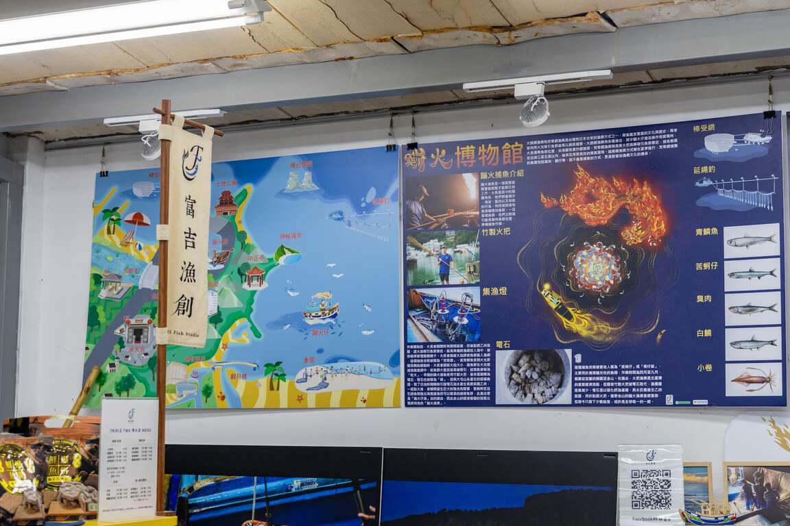
The Fluorescent at Night on the Northern Coast - Jinshan Sulfuric Fire Fishing

Anchor point

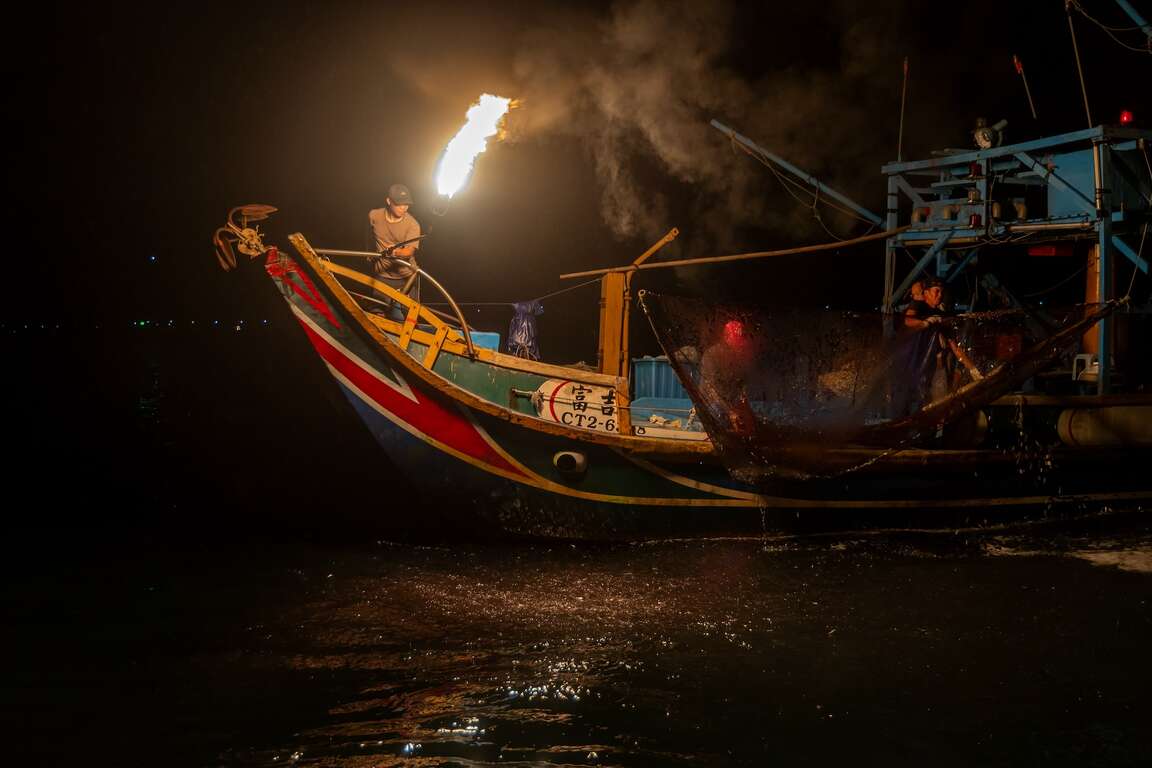
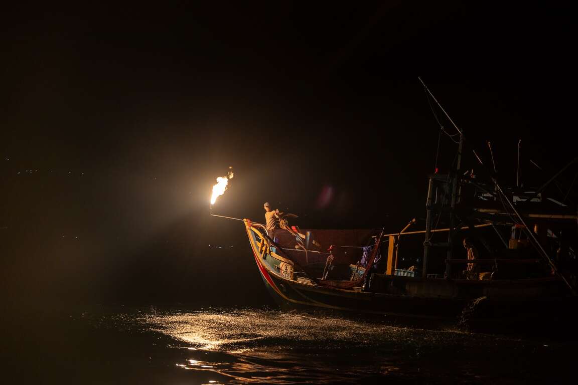
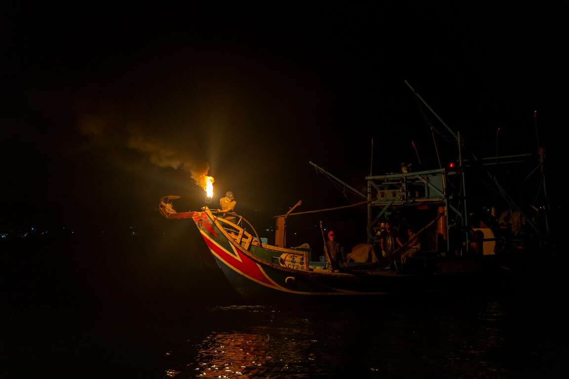
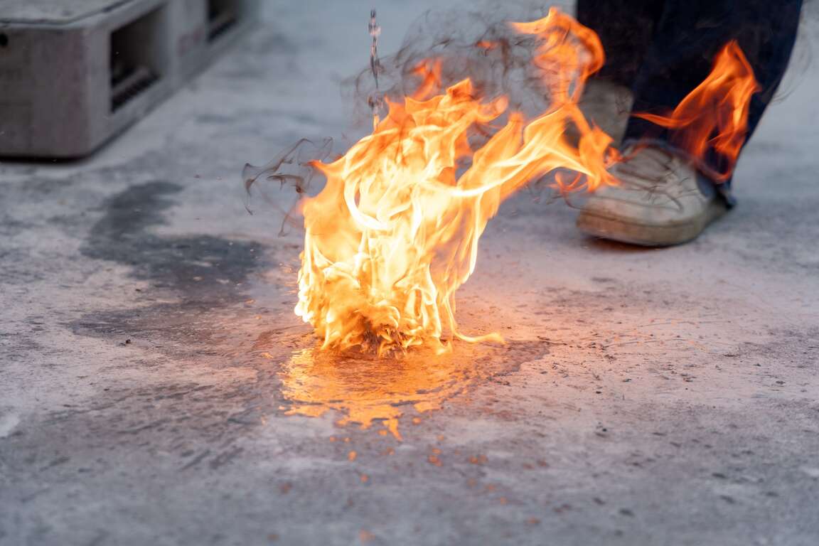
At night, near the coast of Jinshan District, the only on the dark sea surface is the 4000-watt white fish-attracting lights of a neritic squid-catching boat in the distance, the sound of waves, and the sporadic traffic on Provincial Highway 2. Suddenly, a "boom!" sounded, and the flashing torches illuminated the silent sea surface, and the phototaxis small fishes jumped out of the sea one after another. This unique scenery limited to summer comes from the traditional fishing method unique to Jinshan Huanggang Fishing Harbor - "Jinshan sulfuric fire fishing," the most dazzling conventional fishing method in Taiwan.

金山蹦火仔


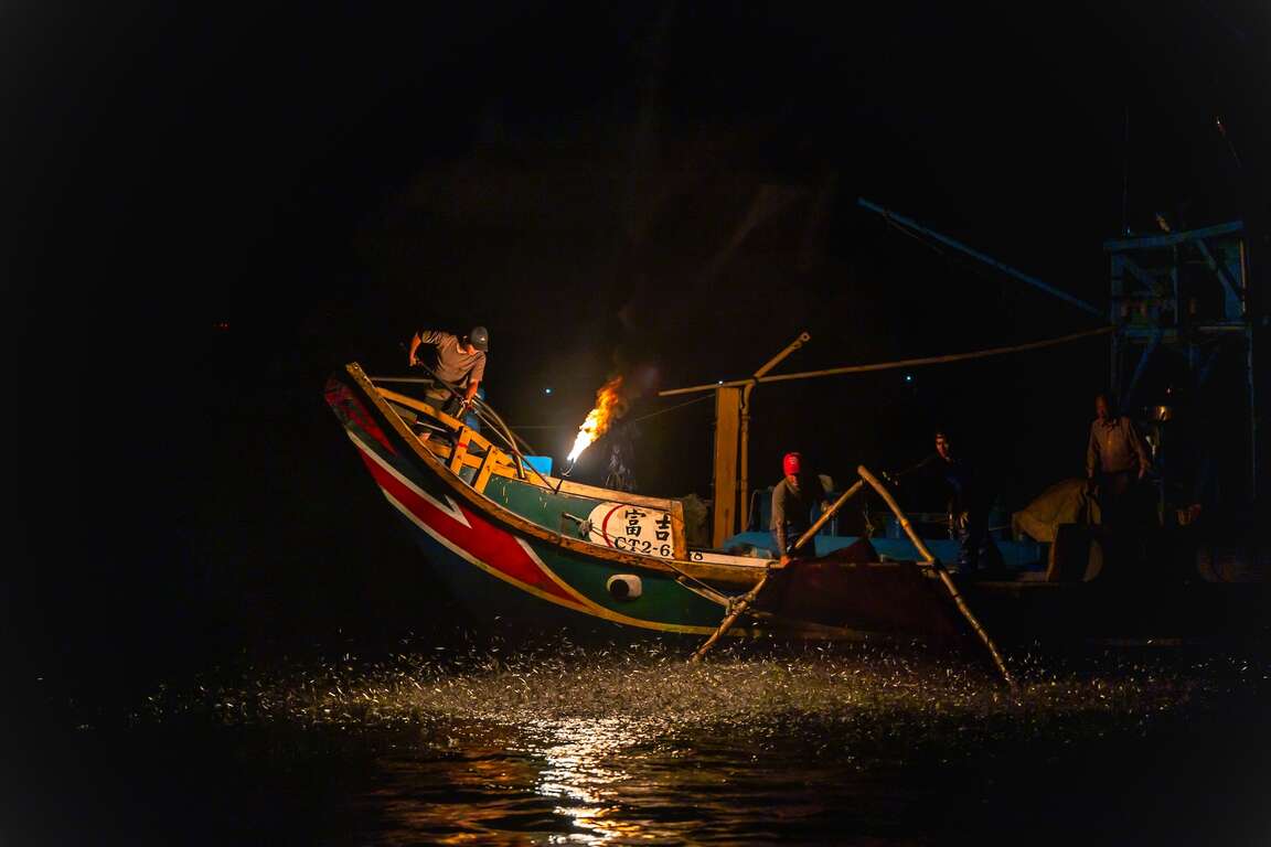
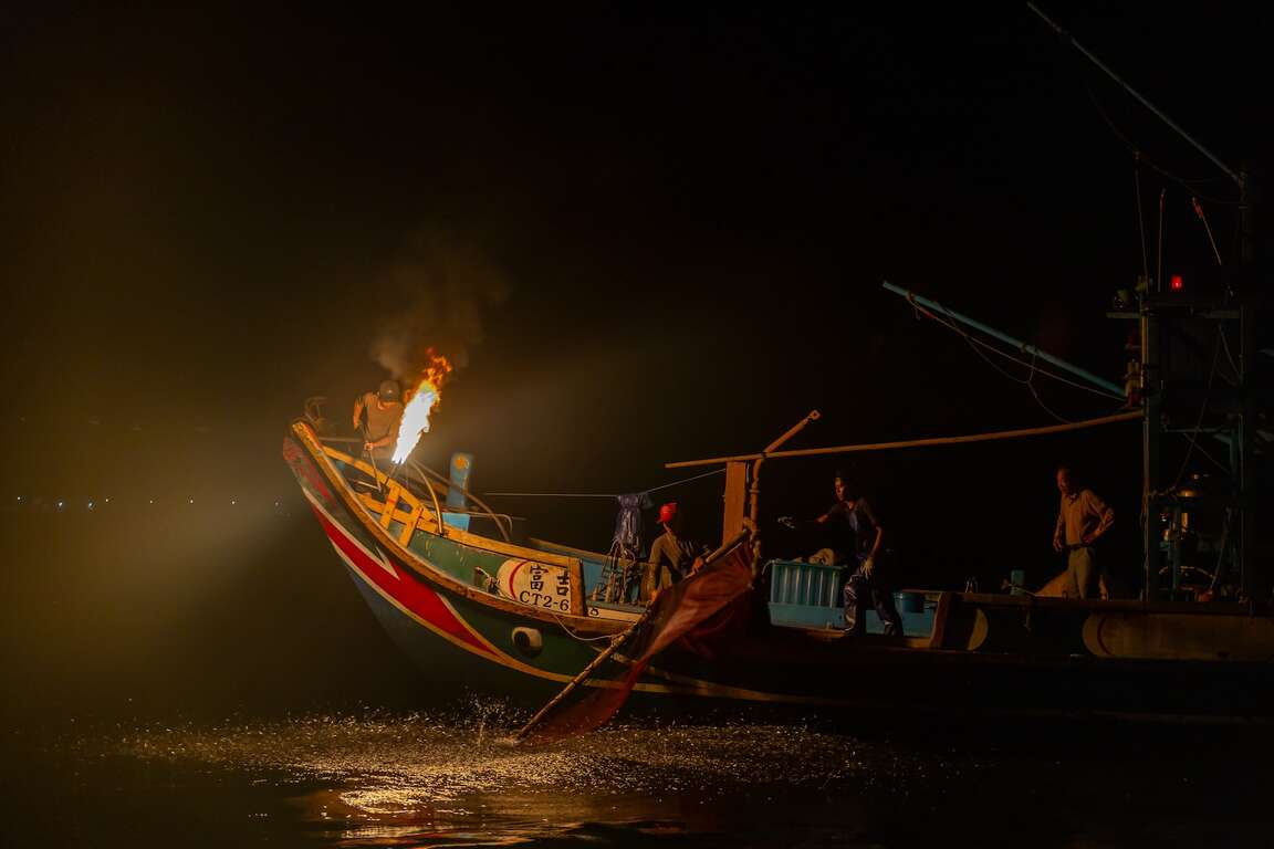
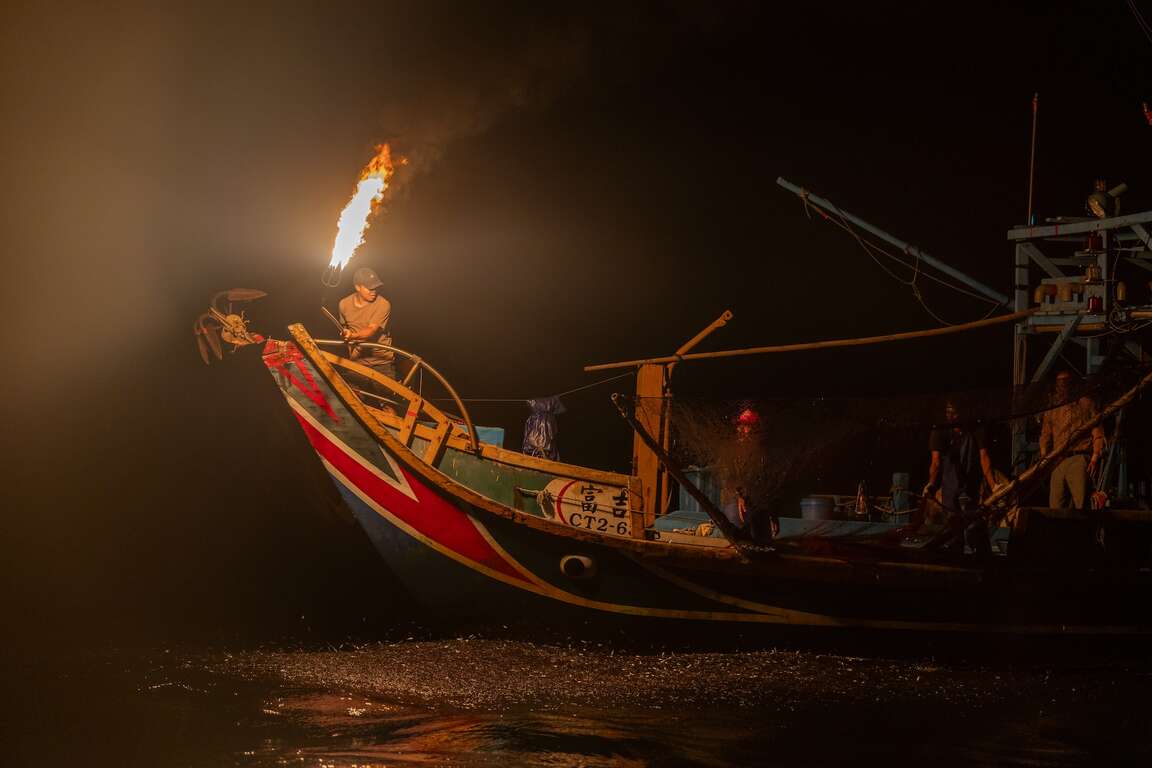
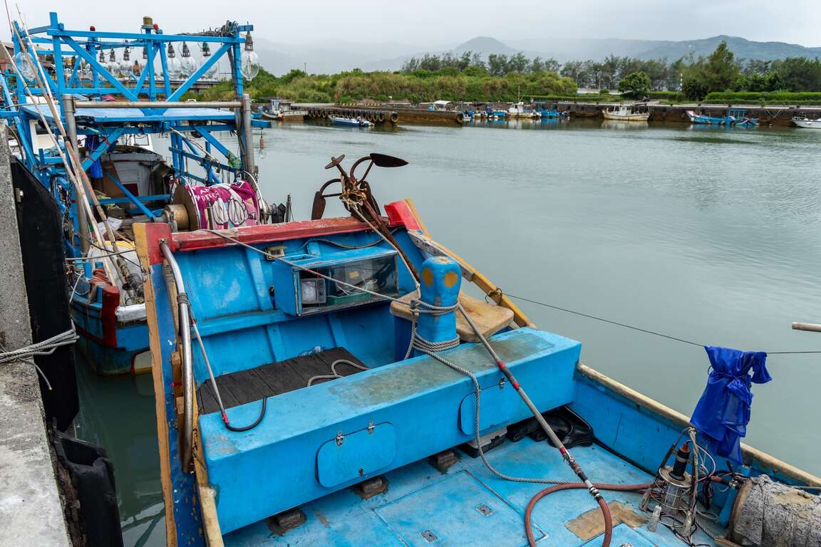
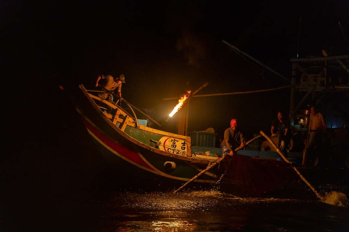
The sulfuric fire fishing boat is also commonly known locally as the "Hia-A-Tsun." Fishing boats set sail at night, and the captain stands at the ship's bow with a torch to attract phototactic fish species, such as pilchard, to jump out of the water, then catches them with a skimming net. It has been a traditional fishing method in Jinshan for a hundred years and was registered as a cultural asset of New Taipei City in 2015. During its heyday, more than 40 sulfur fire fishing boats were operating in the waters off the northern coast. However, in 2016, the T.S. Lines cargo ship ran aground in Shimen, causing an ecological disaster on the north coast due to the oil spill. The June 2017 flood caused seawater desalination in Jinshan, severely damaging the area's marine ecology for the second time and causing schools of pilchard to leave Jinshan. At one point, only one remaining ship, the Fuji 268, was still in operation.

金山蹦火仔


Fortunately, after several years of persistence, some mud carp have returned to the Jinshan coast in the past two years. Also, fishers have transformed the sulfuric fire fishing boat into a tourist experience activity. During the Sulfuric Fire Fishing season, which lasts from May to September every year, they combine fishing village tours with sea fishing to preserve the beauty of traditional fishing methods.

金山蹦火仔

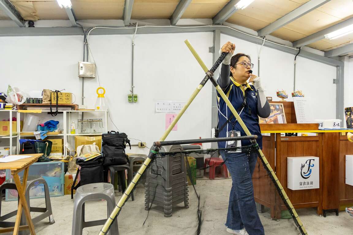
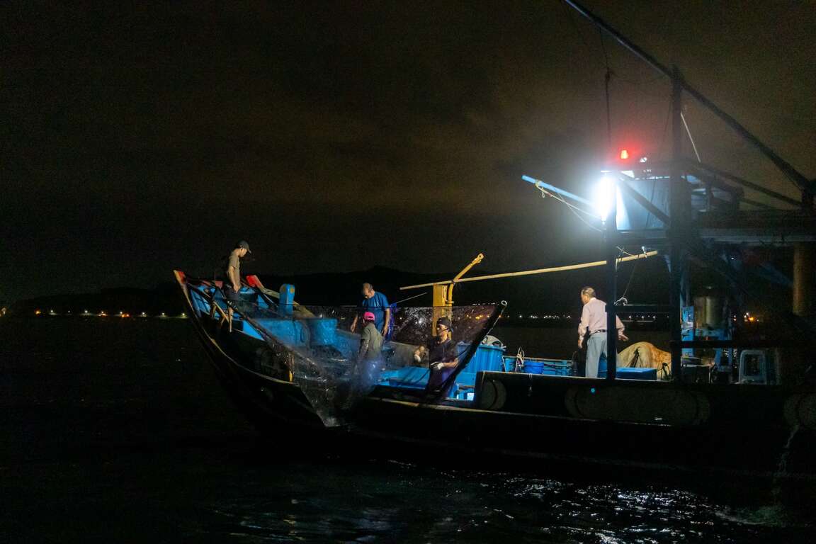
The sulfuric fire fishing boat uses a flat-bottomed and flat-headed boat. It has a low speed but has the characteristics of fast turning and high maneuverability. 4-8 people operate the sulfuric fire fishing boat, including the captain and the fire crews. They use a fish finder on the bow to search for fish. The fire crews then use searchlights to identify the fish species. After ation, they use a torch to attract the light, attracting pilchard, Japanese anchovy, and other fish to jump out of the water. Also called Tainan sardine, pilchard is used as fish bait or grouper feed after processing. When the fishing conditions are good, a sulfuric fire fishing boat can catch more than 800 baskets of pilchard.
金山蹦火仔


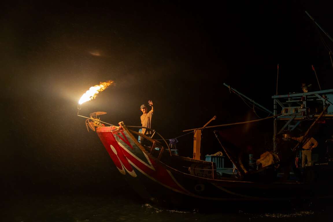
The earliest sulfuric fire fishing boat used bamboo torches. After introducing calcium carbide during Japan's rule, fishers changed the ignition system to calcium carbide. Fishers poured water into the calcium carbide barrel to produce acetylene gas and through the filter cylinder to ignite the torch. The ignition produced a "boom" sound, which is the origin of the name of the sulfuric fire fishing boat today.

金山蹦火仔


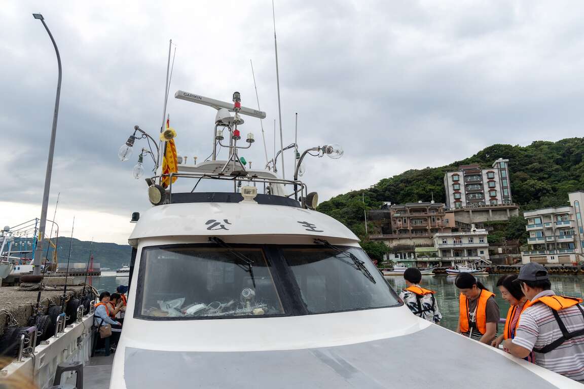
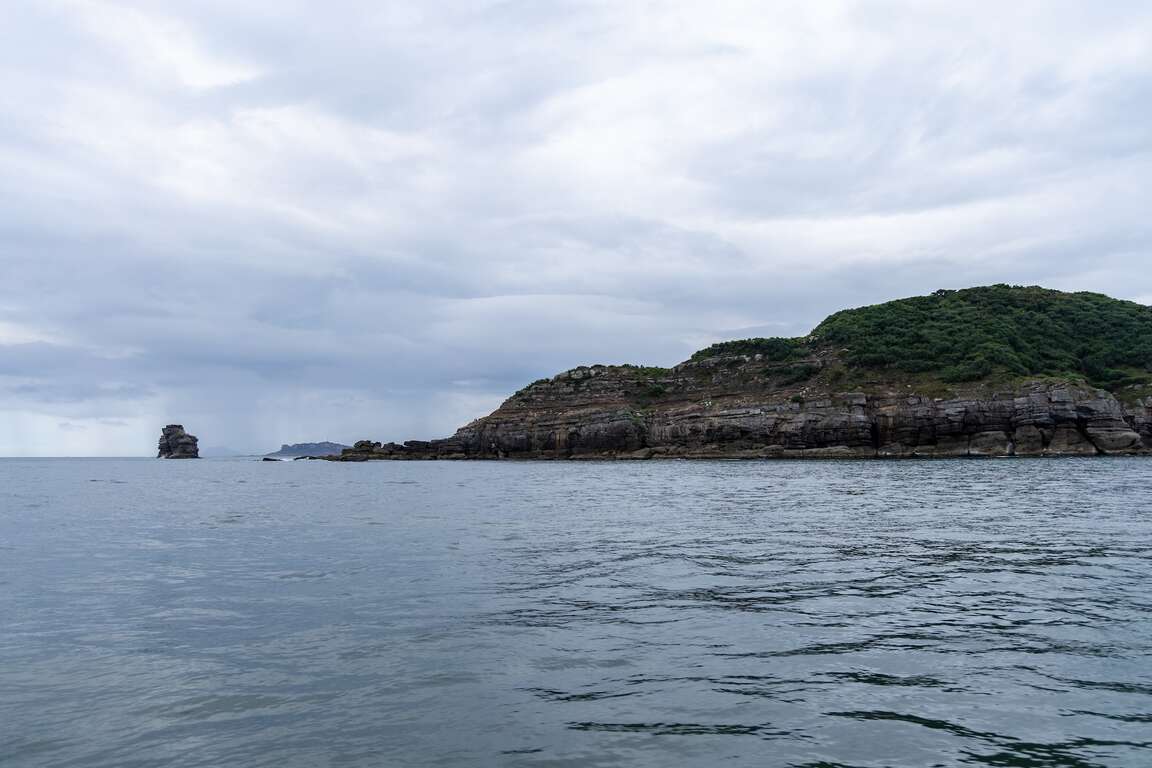
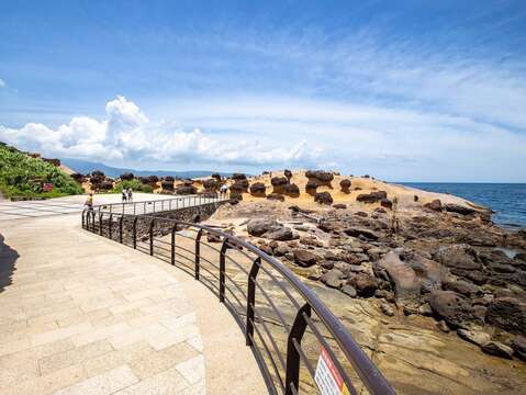
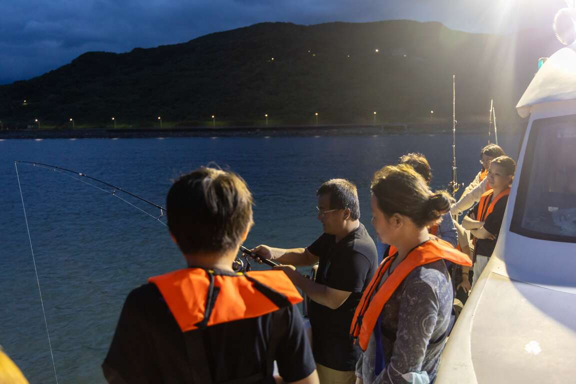
Take a yacht out of Huanggang Fishing Port and enjoy one of Jinshan's eight scenic spots, "Bamboo Peak Mist," while tasting rice noodles with neritic squid. From the sea, enjoy the beautiful coastline of Jinshan and watch the dazzling Jinshan sulfuric fire fishing boat up close after nightfall.

金山蹦火仔
金山蹦火仔

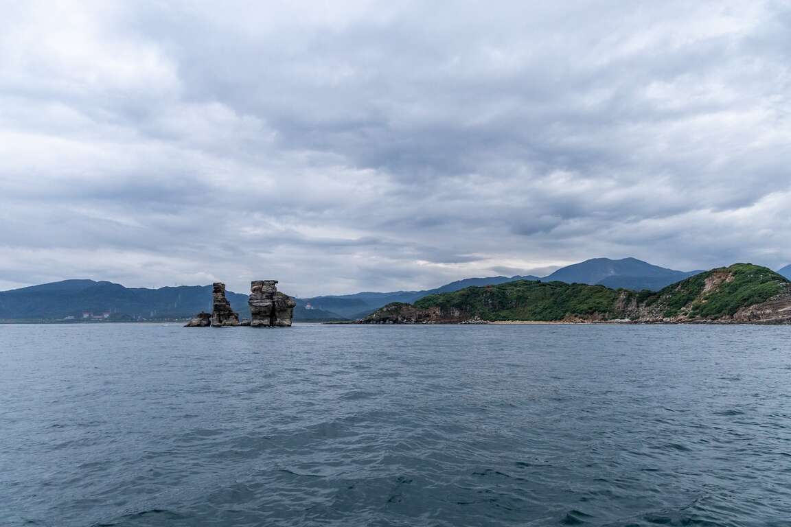
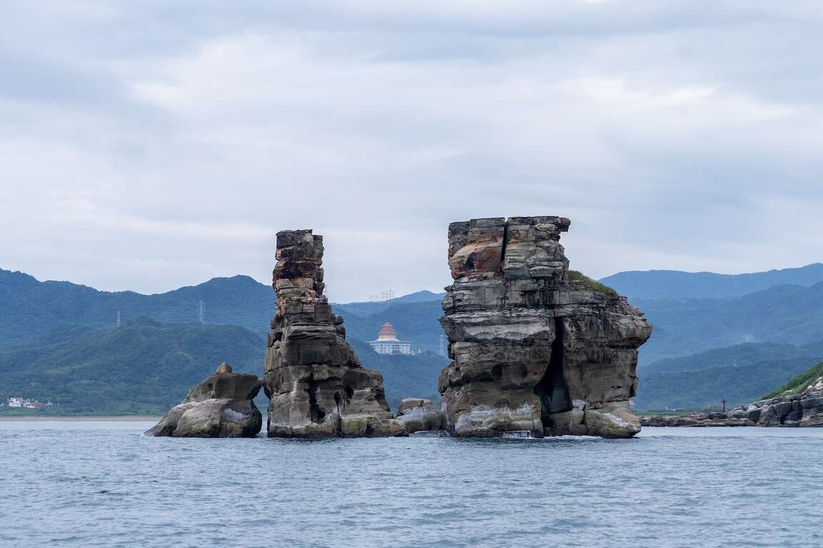
The yacht sails out of Huanggang Fishing Port, and what comes into view is the Jinshan Cape deep into the sea and the most famous landmark of Jinshan - the Twin Candlestick Islets. Besides, overlook the Yehliu Scenic Area and enjoy the scenery of the Jinshan coastline. While waiting for the sulfuric fire fishing boat, pick up a fishing rod and experience sea fishing fun.
金山蹦火仔
金山蹦火仔
金山蹦火仔

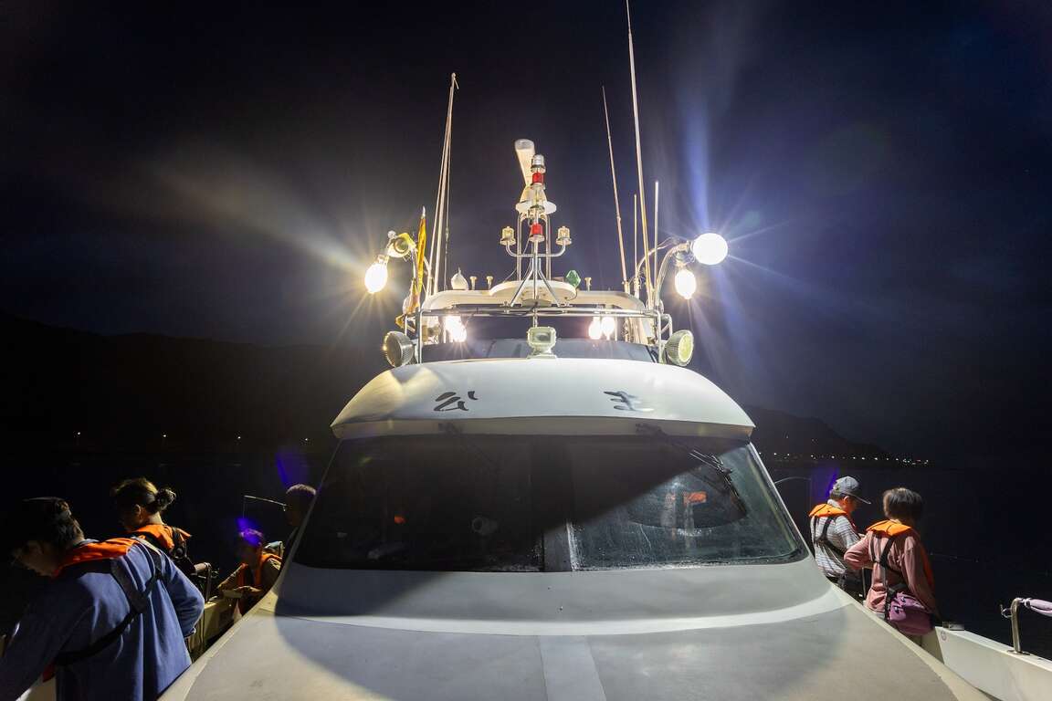
In the waters between Tiaoshi Coast and Yehliu, the sulfuric fire fishing boat used fish finders and searchlights for schools of pilchard at night. The yacht began to turn off the lights. After turning off the lights so as not to affect the sulfuric fire fishing boat's search for schools of fish, the yachts followed the Fuji 268 sulfuric fire fishing boat, everyone in the yacht holding their breath and waiting for the moment when the school of fish jumped out of the water. "Bang!" the gorgeous torches ignited on the sea, illuminating the dark sea of Jinshan. This unique view of the world is undoubtedly a beautiful visual feast.
金山蹦火仔
金山蹦火仔

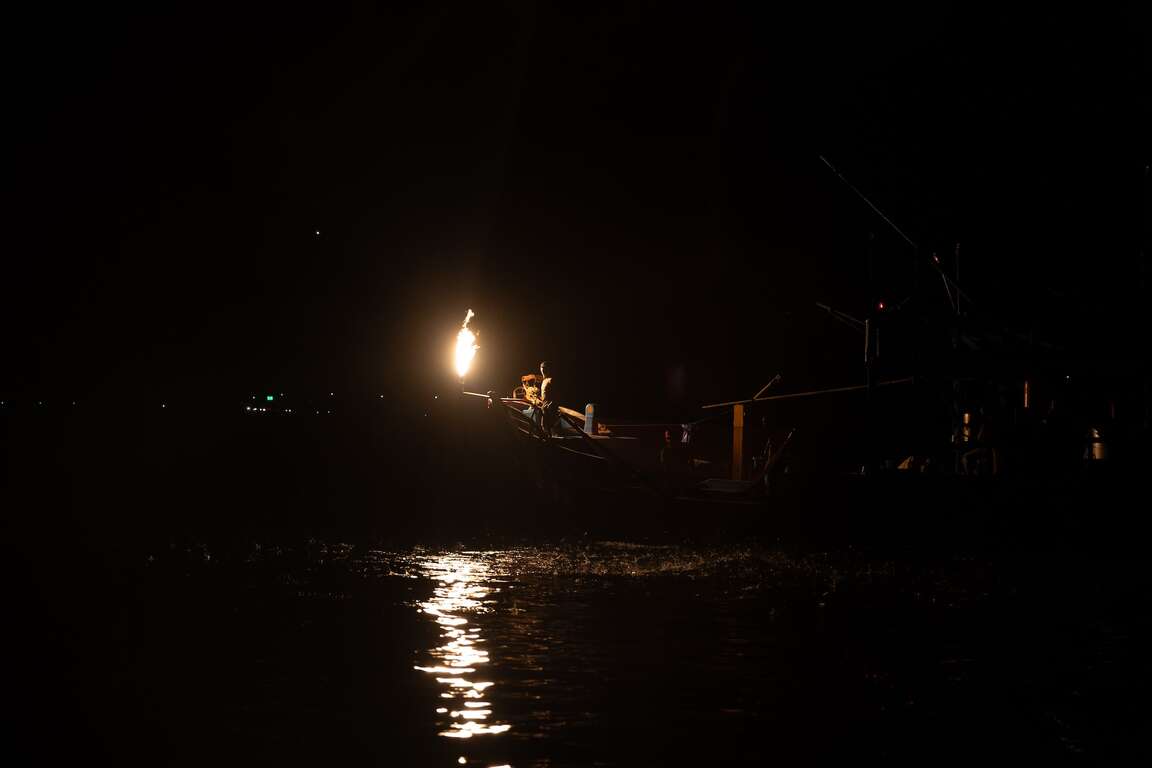
"Yes, here comes fish!" Stimulated by the flames, the school of pilchard jumped out of the water, flashing like fireflies on the sea. The crew members skillfully caught the pilchard with the skimming net, and the passengers on the yacht celebrated with thunderous applause.
金山蹦火仔

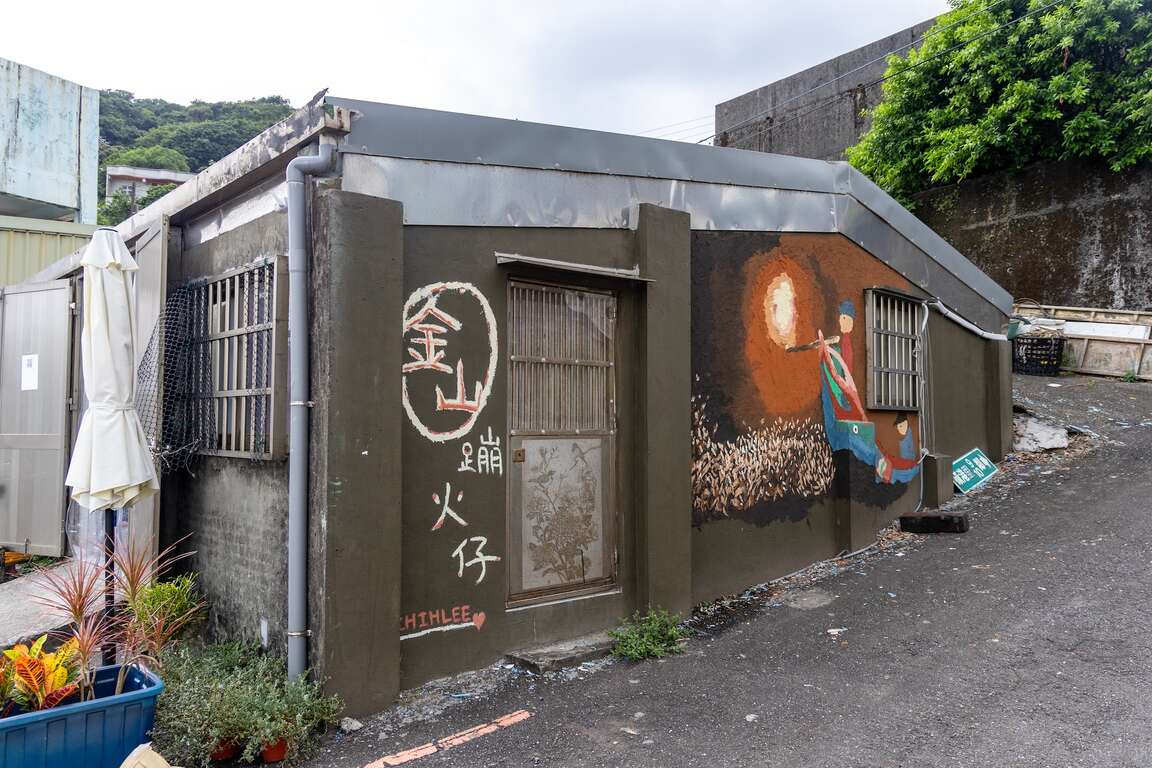
The fire crew waved his hand handsomely to greet the crowd. The flashing torch in his hand is not only a tool for fishing but also carries a sense of mission to continue the tradition and pass on the unique traditional fishing method of Jinshan.
金山蹦火仔
Previous
Tamsui-Kavalan Trails: Hand-made trails, documentaries, and books
The Tamsui-Kavalan Trails were an important mountain trail network that spanned across the Taipei Basin and Lanyang Plain during the Qing Dynasty. They played a crucial role in transportation between these two points before the TRA launched the Yilan Line. The Tamsui-Kavalan Trails should not be regarded simply as a “route” connecting Tamsui Subprefecture and Kavalan Subprefecture. Instead, over the past 200 years or so, the northern section of Xueshan (Xue Mountain) has held invaluable historical memories, including indigenous hunting paths, the footprints of Han people, trading posts, and military patrols. Countless ancestors traversed these dozens of intricate and meandering mountain paths. The Tamsui-Kavalan Trails also bore witness to the development of Taipei City, New Taipei City, Keelung, and Yilan, and can be regarded as Taiwan's pilgrimage route. Today, it has been designated as a “National-Level Green Trail”.2015 and 2016 – “Reappearing the Centuries-Old Tamsui-Kavalan Trails”After the advent of railways and national freeways, the entire world underwent a significant transportation revolution. The Tamsui-Kavalan Trails, which had lost their original transportation function, gradually faded from public view. Nevertheless, for over a century, they have quietly existed within the mountainous region between Taipei and Yilan. Since 2015 and 2016, the Taiwan Thousand Miles Trail Association has collaborated with Taipei City, New Taipei City, Keelung, and Yilan across multiple counties and cities in the joint effort of the “Reappearing the Centuries-Old Tamsui-Kavalan Trails” project. By reviewing literature, maps, interviews, and other sources of information, the Taiwan Thousand Miles Trail Association has obtained the initial route background and, in conjunction with historical, cultural, landscape, recreational system, safety, and other considerations, designed the systematic Tamsui-Kavalan trail routes we have today. It has also adopted the twin-bristle fern as the identifying symbol, establishing the brand of the Tamsui-Kavalan Trails.Combining public and private resources, the government and civilians collaborated to progressively restore these ancient trails using the handcrafted trail method. The concept of handcrafted trails relies not on heavy machinery and construction contractors, but employs simple tools and locally sourced materials instead. Through the participation of volunteers, a collective effort has been made to restore the trails, ensuring their harmonious integration into the existing landscape while preserving the essence of the original cultural pathways. After years of dedicated work, the centuries-old Tamsui-Kavalan Trails, with their rich and enduring history, have been rejuvenated.2018 – “Tamsui-Kavalan Trails Trilogy”To promote the ecology and culture of the Tamsui-Kavalan Trails, the Tourism and Travel Department of the New Taipei City Government collaborated with the internationally acclaimed Director Xiao Qing-yang. They traversed the northern, central, and southern sections of the Tamsui-Kavalan Trails, resulting in the creation of the "Tamsui-Kavalan Trails Trilogy". Director Xiao Qing-yang, through his work spanning from "The Tao of Kung Fu" and "The Tao of Ancestors" to "The Tao of Health" within these centuries-old trails, orchestrated live performances by traditional opera musicians and captured the sounds of nature, including insect chirping, bird calls, and the flowing river water. This endeavor beautifully illustrates the multifaceted vitality of these historical trails.The “Tamsui-Kavalan Trails Trilogy” was honored with the first prize in the Sports and Leisure category at the 14th ART & TUR – International Tourism Film Festival in 2021. In 2023, the original soundtrack album “Beginningless Beginning” produced for “Tamsui-Kavalan Trails Trilogy” achieved a remarkable feat by winning the Best Recording Package award at the 65th Grammy Awards, propelling Tamsui-Kavalan Trails onto the international stage2019 – “Tamsui-Kavalan Trails – The Northern Section”The first travel guidebook for the Tamsui-Kavalan Trails, titled "Tamsui-Kavalan Trails – The Northern Section", was brought to life through the combined efforts of the Taiwan Thousand Miles Trail Association, historians, and mountaineering experts who possess an intimate knowledge of these trails. After meticulous planning and 18 months of dedicated compilation, the guidebook was officially launched. The book provides insights into the cultural history, town stories, flora and fauna ecology, along with recommended routes along the northern section. Its high-quality layout garnered immediate acclaim upon release, and to date, it has undergone five printings. Many travelers set out on the northern section of the Tamsui-Kavalan Trails with this book in hand to experience these historic trails step by step, and craft their own unique stories along the way.2020 – The website themed on the Tamsui-Kavalan TrailsA website themed on the Tamsui-Kavalan Trails was developed relying on the smart technology. This innovative UI/UX interactive trail map simplifies the intricate network of trails within the Tamsui-Kavalan Trails. From users' perspective, this website integrates and interfaces information related to pre-trip preparations, itinerary planning, GPX data, transportation, weather, and rest stops. Easily capture all types of hiking information, and comprehensively explore the abundant history, culture, humanities and ecology of the Tamsui-Kavalan Trails.2022 – “Tamsui-Kavalan Trails – The Long and Slow Journey through Centuries-Old Satoyama”Following the publication of the acclaimed "Tamsui-Kavalan Trails – The Northern Section", the Tourism and Travel Department of the New Taipei City Government once again collaborated with several experts of the Tamsui-Kavalan Trails to introduce the book "Tamsui-Kavalan Trails – The Long and Slow Journey through Centuries-Old Satoyama". This book portrays the travel experiences along the northern, central, and southern sections of the Tamsui-Kavalan Trails, along with visits to the stories of 22 local artisans and businesses within the Tamsui-Kavalan Trails. It includes a practical hiking guide for the entire route and exquisite photographs. The book also features an exquisite fold-out map, hand-painted by an artist who has received the Golden Tripod Award after personally walked through all sections of the Tamsui-Kavalan Trails. It also includes the stories behind the planning and branding of the Tamsui-Kavalan Trails, with the hope of embarking on the next century together.The Tourism and Travel Department of the New Taipei City Government has successfully promoted the Tamsui-Kavalan Trails for many years. Today, these trails are internationally and domestically renowned long-distance trail. In addition to marketing and promotion through the internet, videos, and books, the Department has also collaborated with numerous non-governmental organizations to organize activities such as handcrafted trail workshops, mountaineering seminars, and National Greenway guide training. Let this centuries-old historical trail continue to thrive through people's interactions and visits.
Next
The Must-see Attraction for Foreign Visitors- the Yehliu Geopark
You only have a week in Taiwan and do not want to spend too much transportation time? Then you definitely cannot miss the "world-famous" tourist attraction- the Yehliu Geopark. I assume you have done your research on the must-see attraction that people are talking about before coming to Taiwan. Have you heard of the "alien planet" in the northern Taiwan? If no, please add it to your travel to-do-list. The Yehliu Geopark is located in the suburban area of Taipei City. It is 40 minutes away from downtown by public transportation. The long and narrow capes sticking out from the island are eroded by the strong northeast monsoon, and with the weathering and coastal erosion, the "Mars landscape" is thus generated. There are lots of rock types here and you can even see gradient colors on some of the rocks. The famous rocks will be introduced below. You will definitely be amazed when seeing the art of nature in person!Pedestal rock area/ wave-cut platform- 2 main characteristics of the GeoparkIn the first area, you will see lots of pedestal rocks, ginger shaped rocks and candle shaped rocks. When looking around, pedestal rocks are everywhere. With time passing by, the hard concretion inside the sandstone is exposed, and with the effect of wind, sun, rain, wave as well as the erosion of the northeast monsoon, the pedestal rocks of different shapes, such as the pedestal rocks with no necks, bulk necks, narrow necks and broken necks, are thus formed. The landscape with lots of pedestal rocks is very uneven, so pay attention while you are walking on it. Do not be too focused on taking photos or enjoying the view and fall.The second area on the other side of the Geopark has the wave-cut landscape. You will find sea caves, coastal notches, wave-cut platform and cuesta. On one side of the wave-cut platform is the cliff and on the other side is the rapid wave. You will find lots of interesting rocks eroded by the seawater here, including the Twenty-four Filial Exemplars Rocks.Landscape Wonder- The Pedestal RocksWhen first walking into the Geopark, you will see a huge area of the pedestal rocks. When seeing afar, it's like the cute mushrooms park. And the pedestal rocks are the landscape that attracts most people in the Yehliu Geopark. The process for the formulation of the pedestal rock is first the rock formation exposed from the sea surface, and the seawater will erode the rock continuously. After some time, the hard concretion inside the sandstone is exposed, and with the effect of wind, sun, rain, wave as well as the erosion of the northeast monsoon, the pedestal rocks of different shapes, such as the pedestal rocks with no necks, bulk necks, narrow necks and broken necks, are thus formed. The different shapes of the rocks represent the different formation processes. The landscape with lots of pedestal rocks is very uneven, so pay attention while you are walking on it. Do not be too focused on taking photos or enjoying the view and fall.The Star of the Geopark - "Queen's Head"The next coming up is the star of the Yehliu Geopark, "Queen's Head". The Queen's Head is a kind of pedestal rock. When the crustal structure was rising, the differential erosion of the seawater made the Queen's Head what it is like today. If we divide its height by the average crust rising speed in northern Taiwan, we will learn the Queen's Head is about 4,000 years old. The Queen's Head is a kind of pedestal rock. However, the joint on its upper concretion broke during 1962-1963. When viewing from a certain angle, it looks similar to the head portrait of Elizabeth II and thus acquires the name. With the natural weathering effect over the decades, the neck of the Queen's Head is getting even narrower. To prevent erosion by human activities for that tourists might touch it, the Queen's Head is now under protection. If you would like to take a photo with the Queen's Head, you can walk on the wooden plank trail to line up. Besides, you can view the Queen's Head from afar and take photos with it on the trail.The "Cute Princess Rock" and "Candle Shaped Rock" are the popular landscape at the Geopark. The formation process of the "Cute Princess Rock" is similar to that of the Queen's Head. The eroded rock looks like a princess with a ponytail and is said to be the potential replacement of the Queen's Head. Doesn't the rock look like a little girl with her hair in a bun? Though the Cute Princess Rock is probably not as element and sophisticated as the Queen's Head, it gives people a feeling of passion and sweetness.How was the "Candle Shaped Rock" named? I guess you already know! The landscape looks just like candles. There are 3 main processes for the formation of the Candle Shaped Rock. First the candle fire is exposed, and the area around it is eroded to form a groove. Finally, the candlestick is cut and the Candle Shaped Rock is thus formed. The candle fire is actually a round concretion in the rock formation. When seawater erodes sandstone, the round concretion which is harder is exposed on the ground. And when waves dash against the concretion, seawater flow around the concretion to erode the sandstone around it. A groove is formed as a result. Since the formation outside the concretion is harder, seawater will flow according to the shape of the formation and cut the rock into a cone shape that looks like a candlestick. And a rock that looks like the shape of candle is formed by mother nature.Amazing Rocks- CuestaNow let's look at the beautiful scene of the Cuesta in the second area. Walking along on the road to the Cuesta, you will see the most beautiful sea and mountain scene in the Geopark. You can view the Cuesta on one side and the sea cliff as well as wave-cut platform on the other side.The Cuesta features a sharp cliff on one side and a smooth slope on the other side. It is formed because the main stratum is pushed by uneven force and speed, which results in uneven rise of the stratum. When the stratum is pushed, the lump on the ground will cause the stratum to break. And after the seawater erosion, a landscape that looks like a "natural slide" is gradually formed.Guess how famous is the Yehliu Geopark? CNN once reported that the scene at the "Yehliu Geopark" is like the landscape in the outer space and that it has the environment that looks just like the one Mars has. You will definitely find lots of gorgeous and special rocks, including the "Queen's Head", "Ice Cream Rocks", "Beehive Rocks", "Ginger Shaped Rocks" and other wave-cut landscape. You will definitely be amazed by the diverse geologic structure and landscapes here. What's more, you can see how great and powerful nature is. Whether it's from the perspective of geographic environment or location and transportation, the Geopark is definitely worth visiting!Transportation Information of the Yehliu Geopark*Tamsui Bus No.862 (Take the bus heading to Keelung in front of MRT Tamsui Station and get off at Yehliu.) The bus sets out every 30 minutes.*KUO-KUANG eBus No. 1815 (Take the bus heading to Chinshan Youth Activity Center at the KUO-KUANG eBus Station at Taipei Main Station. The Bus drives along Zhongxiao E. Road and makes a brief stop at the Taipei City Hall Bus Station. Please get off at Yehliu.) The bus sets out every 20 minutes.*Keelung Bus No.790 (Take the bus heading to Jinshan next to Keelung Train Station and get off at Yehliu.) The bus sets out every 15 minutes.*Keelung Bus No.1068 (Take the bus heading to Jinshan at National Taiwan University and get off at Yehliu Geopark.)*Keelung Bus No.953 (Take the bus heading to Jinshan at the bus station next to Banqiao Train Station and get off at Yehliu Geopark.)Nearby Places to Go Jinshan Wanli Cycling Route-->Jinshan Wanli Hot Spring
Back to the top of page
小客帶路