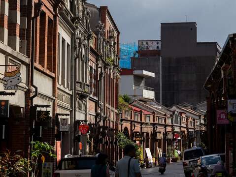
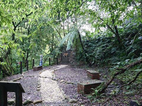
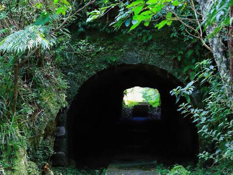
New Taipei City advances low-carbon tourism by emphasizing transportation, meals, and attractions, working to reduce travel emissions. Professional institutions calculate carbon footprints, and VCS-certified carbon credits are purchased to achieve sustainability. The Sanxia low-carbon tour begins at the environmental education site of Lujiaoxi Constructed Wetland, continues to TINA Kitchen eco-restaurant for healthy seasonal meals, proceeds to New Taipei City Art Museum for an art experience, and concludes with a guided walk through Sanxia Old Street to appreciate local cultural heritage.Spanning 16 hectares, Lujiaoxi Constructed Wetland sits at the confluence of Dahan River and its tributary Lujiao River. Once a landfill, the site was renovated by the New Taipei City High Riverbank Construction Management Office into a constructed wetland, becoming New Taipei's first on-site wastewater treatment facility certified by the Environmental Protection Administration .Using aquatic plants and natural purification methods, Lujiaoxi Wetland effectively improves Dahan River’s water quality through sedimentation, filtration, and biological absorption. The wetland attracts numerous bird species and amphibians, creating an excellent ecotourism destination. Environmental volunteers guide visitors through wetland plants—giant elephant’s ear, shell ginger, paper mulberry, fountain grass, flute reed, wild sugarcane, and silvergrass, and ecology.TINA Kitchen, near Yingge Ceramics Museum, embraces the "farm to table" philosophy, offering 16 main course options plus an extensive self-service bar featuring fresh vegetable salads, dessert breads, and various hot and cold teas and coffee—balancing flavor with health. The "Organic Yam" brand maintains its commitment to 'organic agriculture + organic food processing + organic living,' extending into organic bakeries and natural soap workshops, practicing environmentally conscious, organic lifestyles.New Taipei City Art Museum sits in Yingge, renowned for ceramic craftsmanship. Designed by architect Kris Yao, the silver-white structure takes inspiration from riverside reeds, expressing wind-swept movement through staggered vertical lines. Incorporating green building principles, the museum uses expansive glass to draw natural light inside while balancing ventilation and insulation, creating comfortable viewing conditions. The extensive outdoor grounds provide habitat for numerous Taiwan-endemic species, establishing the museum as a significant New Taipei landmark combining aesthetics with environmental consciousness.Follow the Can Culture, Art & Nature on a guided walk through Sanxia Old Street. This 260-meter street winds S-shaped along Sanxia River. In earlier times, a light railway transported tea and coal from Sanxia's hills. Most existing street houses date back a century. Continuous red-brick arcades and baroque archways create Sanxia Old Street's distinctive character. Examining the facades reveals intricate decorative styles—each building's gable and nameplate designs contain unique architectural language, made more vivid through the guide's commentary.Built in 1769, Sanxia Qingshui Zushi Temple underwent reconstruction led by art master Li, Mei-shu, incorporating works by craftsmen from various schools and contemporary artists. It's acclaimed as the "Oriental Art Palace." The guide leads visitors through the temple's elaborate caisson ceilings, vibrant cut-and-paste decorations, and exquisitely carved stone pillars.The Can’s Haksip Village sits beside Sanxia Old Street. Originally Alin Hospital founded in 1947, it transformed into a local revitalization hub starting in 2017, earning recognition as one of the Ministry of Culture's Top 100 Cultural Bases. Haksip Village takes its name from Taiwanese for "collective learning," connecting craft artisans, specialty food merchants, community schools, and corporate partners to build community support networks.The village hosts Hidekawa Fermentation Workshop and Tofu House, Sanyi Metalworking, Shike Studio, and Grass Book House. Hidekawa uses non-GMO domestic soybeans contract-farmed from the Jianan Plain to produce tofu products and miso, reducing food miles. Sanyi Metalworking and Shike Studio preserve and advance traditional crafts while offering hands-on experiences in metalworking, wood carving, and gold hammering techniques. Experience Haksip’s collaborative spirit in the village, and try Hidekawa’s tofu ice cream combining Sanxia Biluochun tea with domestic soybeans—tea and bean fragrances intertwining as the tour concludes.The "Art Realm New Taipei: Sanxia Slow One-Day Tour" meets the Ministry of Environment's "Green Tourism" standards and appears on the "Green Lifestyle” information platform. Carbon footprint calculations show this tour produces 10.2 kg CO2e per person.