Go to the main content section Anchor point

New Taipei City Travel

Tamsui and Shiding Ancient Trails Trio

Anchor point
Category :
Hiking Trails & Outdoor excursion & Nostalgic tour of the old street
Travel days :
1 day
適合對象 :
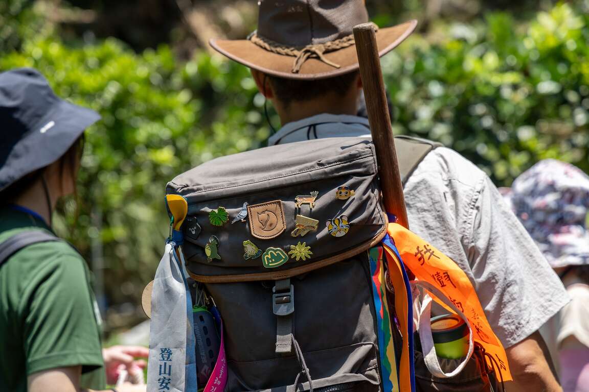
Public & Backpackers

推薦路線

Day

      Introduction

      Anchor point
      Shiding District is the geographical center of New Taipei City, the main catchment area of Feicui Dam, and an essential path along the southern route of Tamsui Kavalan Historical and Cultural Trails. Many approachable trails around Shiding Old Street are suitable for families to wander together. From the Tamsui-Kavalan Suspension Bridge, you can walk along the Waian Historic Trail, Wutuxi Trail, and Sifenzi Historic Trail, bathing in the green mountain trails. Then, go to the bee farm and tea garden on the Beiyi Highway to learn about the ecology of bees, taste tea, and feel the infinite vitality of the real estate industry.
      淡蘭吊橋

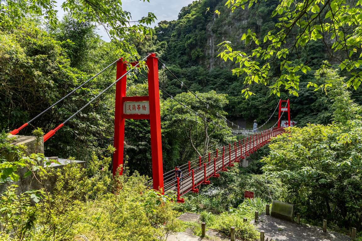
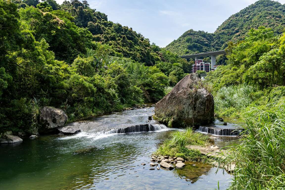
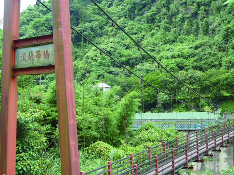
      The Dipteris Conjugatas standing at the end of the Tamsui Suspension Bridge marks this place as an important scenic spot of the Tamsui Historic Trail. The red bridge of the Tamsui-Kavalan Suspension Bridge spans the Shiding River, and the pavilion and stone slabs simulate the scene of the transport wharf in the past. After crossing the suspension bridge, enter the Waian Historic Trail, go under the tall National Freeway 5 viaduct, and head to Shiding Old Street.
      淡蘭古道標示
      淡蘭吊橋

      The southern route of Tamsui-Kavalan Historical and Cultural Trails is known as the "Tea Road." In the mid-19th century, after Taiwan opened its ports, tea became an essential international export commodity for Taiwan. The vast mountainous area between Taipei and Yilan became a significant tea production center, and the settlements in the valleys became trading bases for tea merchants. People transported Baozhong tea from the Shiding and Pinglin areas to Muzha, Jingmei, and Bangka along the southern route of Tamsui-Kavalan Historical and Cultural Trails and Jingmei River waterway transportation network. After being processed and packaged in Dadaocheng, the merchants shipped the tea out of Tamsui to the world.
      淡蘭古道石碇外按古道
      古道上的貓

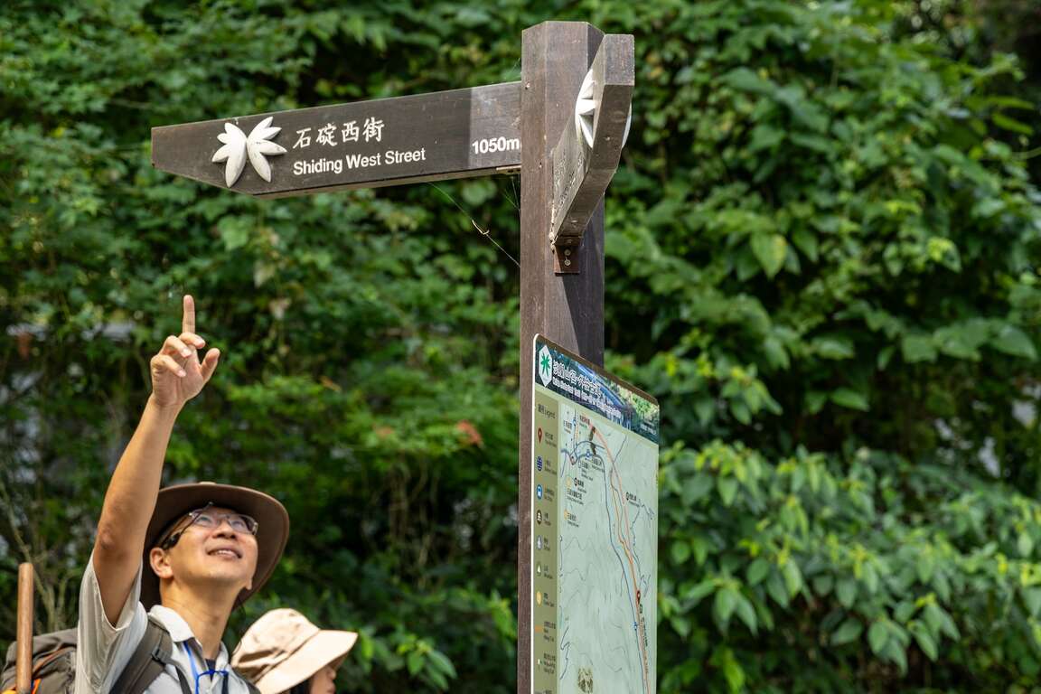
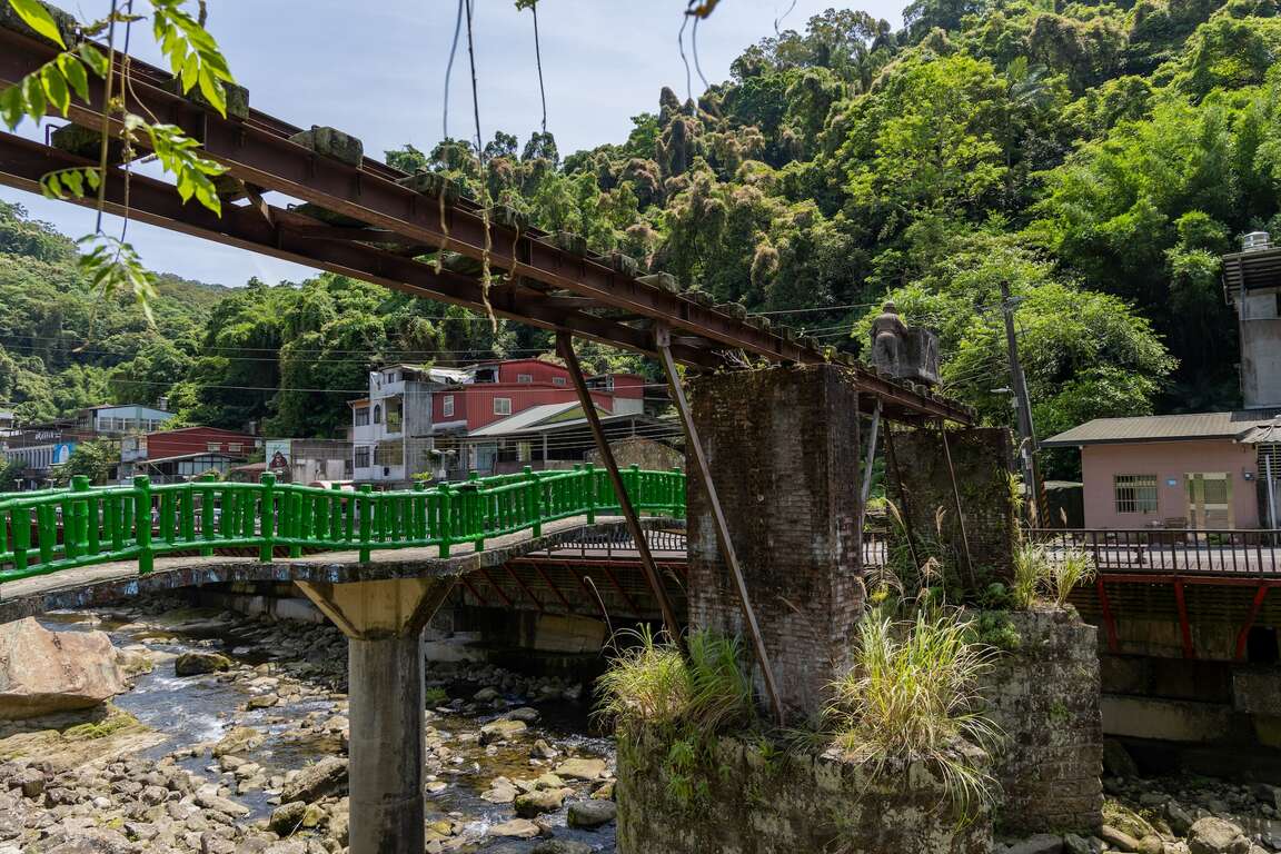
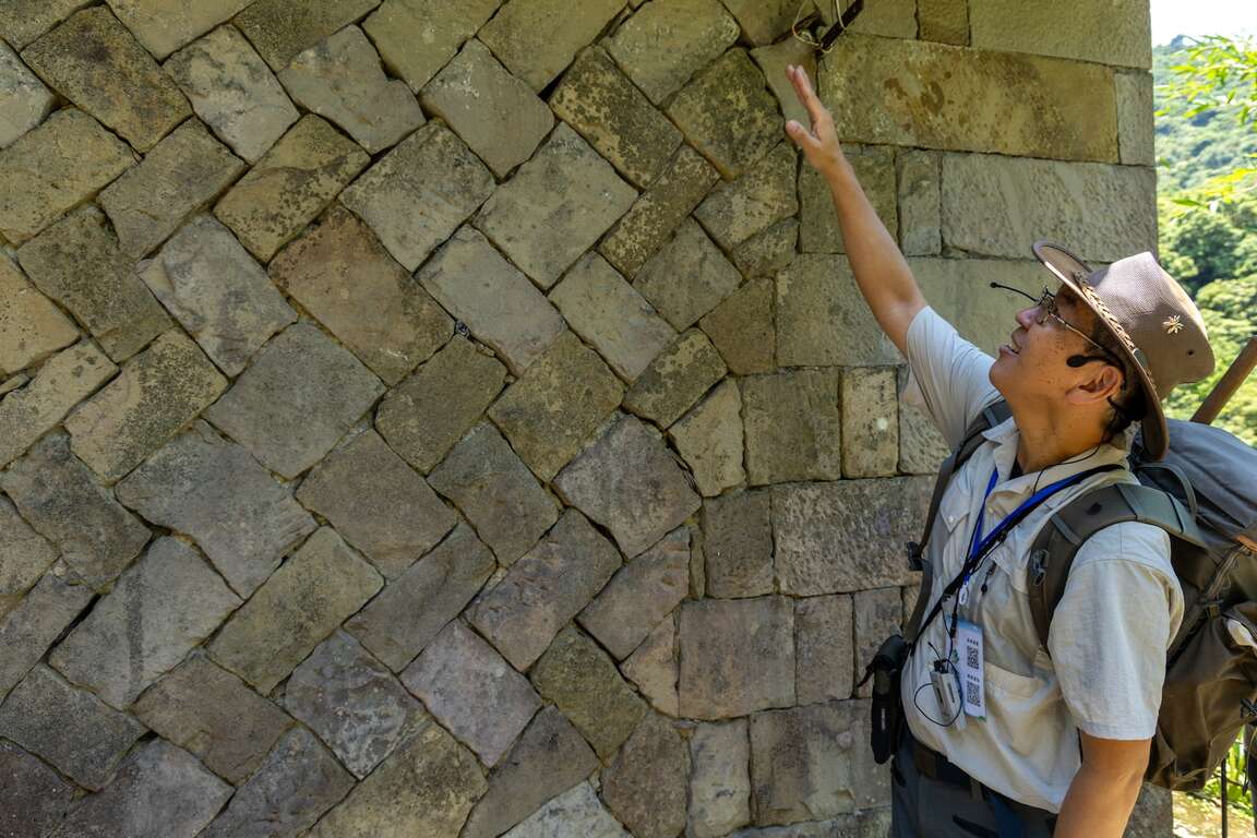
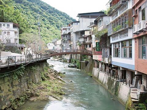
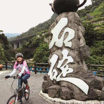
      The endpoint of the Waian Historic Trail: Shiding Old Street is the earliest developed area in Shiding. It is divided into two streets, east and west, by the Wanshou Bridge, built with stone bridge piers. The century-old tofu shop, the unique hanging-leg building (diaojialou), and the skyless street on the old street are all classic attractions in Shiding. Passing by the Shiding Elementary School, which is more than 120 years old, reflects a flourishing population of Shiding during the coal mining period in the early years.
      淡蘭古道南路
      淡蘭古道

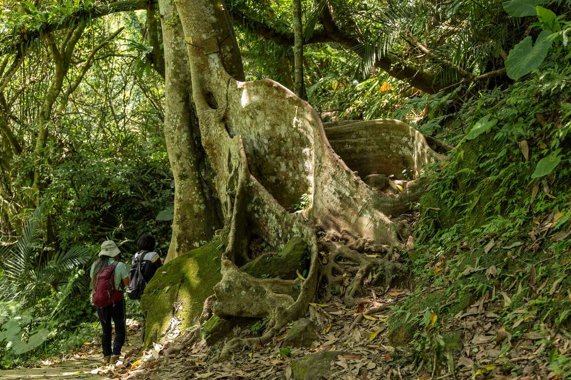
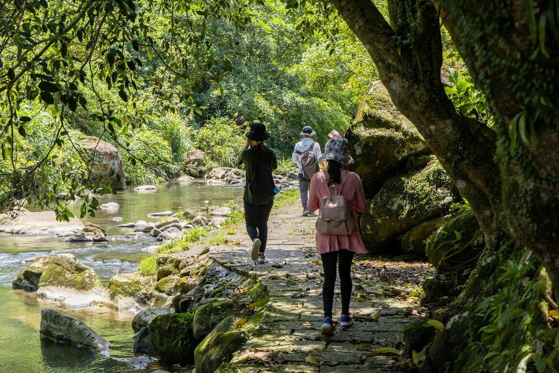
      After passing through Shiding Elementary School, connect to the Wutuxi Trail built along the left bank of the Wutuxi. The trail is roughly parallel to Dingge Road, with a total length of about two kilometers and gentle undulations. Bamboo forests lined the path along the way, accompanied by Formosa Acacia, tung flowers, ficus variegata blume, nest ferns, and lagerstroemia subcostata of Shansu and Han. Besides, fishing protection policies allow rivers to retain various fish species, with clear and transparent water quality and a rich and diverse ecosystem.
      大板根
      烏塗溪步道
      烏塗溪步道

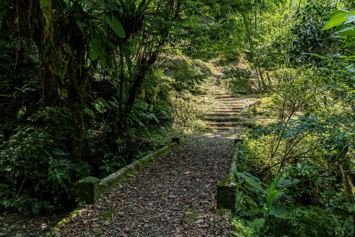
      The Sifenzi Historic Trail is a mountain trail connecting Sifenzi and Yueshan Lake. Along the trail, you can see many historical sites, such as a stone bridge, stone houses, a Tudi Gong temple, tea plantations, terraced fields, and bamboo gardens.
      四分子古道-石板橋
      四分子古道
      四分子古道-土地公廟
      四分子古道-石頭屋


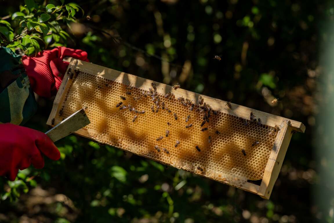
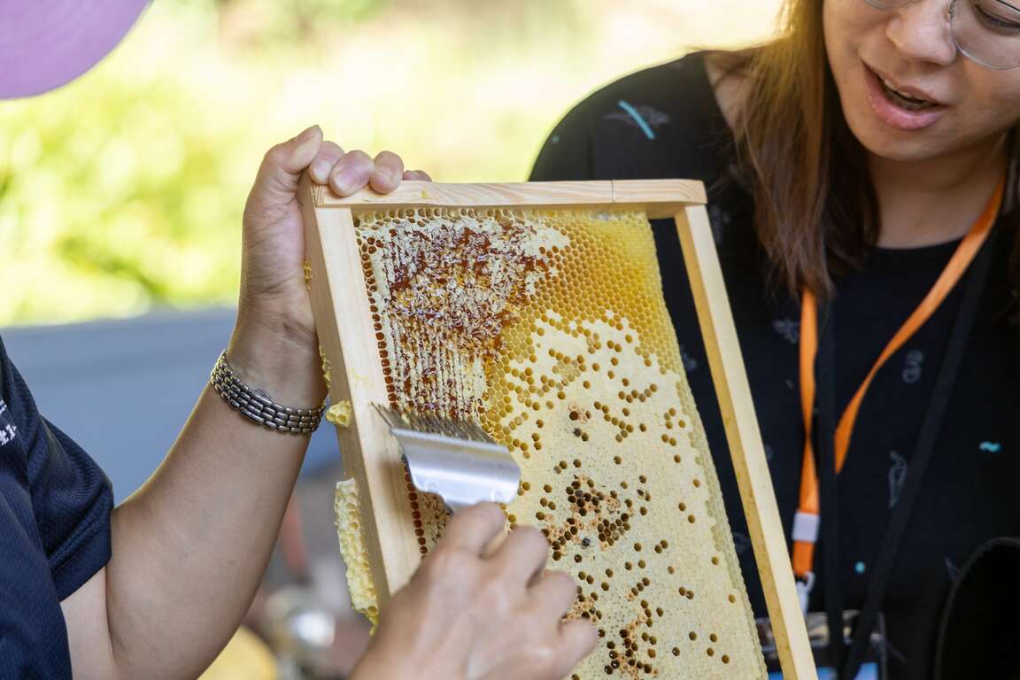
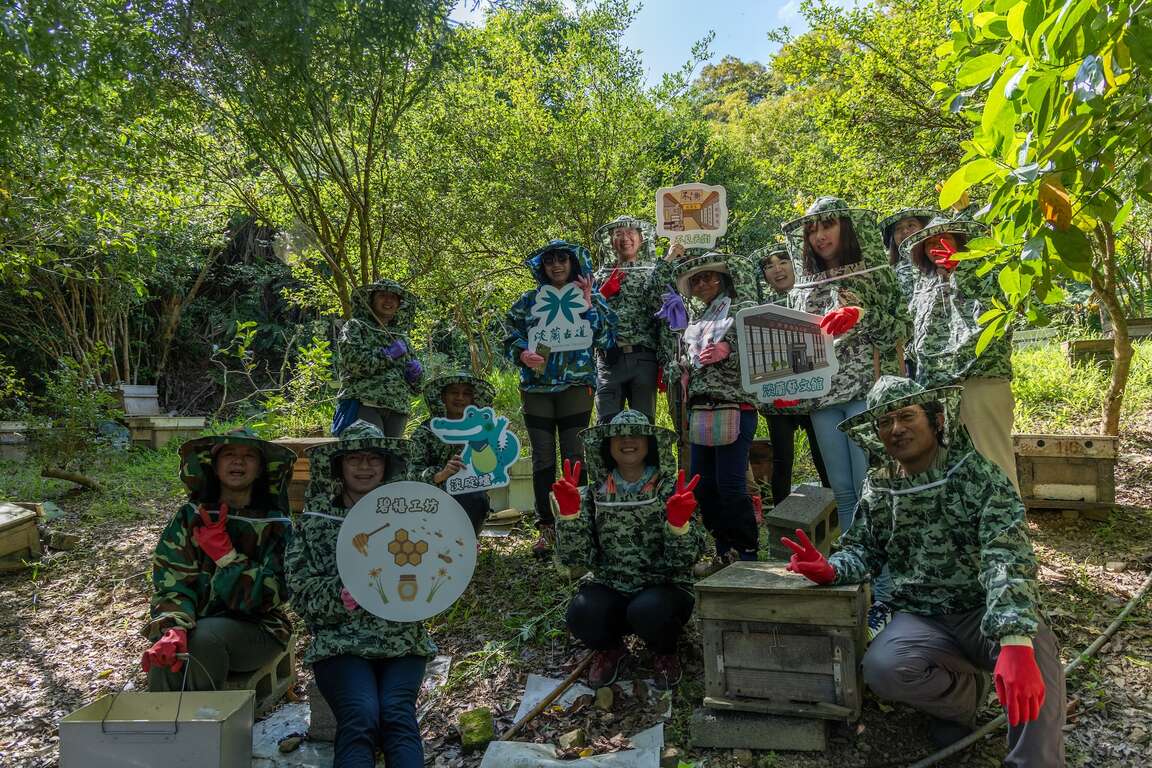
      The picturesque scenery of Shiding has attracted many people who love mountain life to build their homes here. After walking the three major mountain trails in Shiding, arrive at the Mamami Honey, about a 5-minute drive from Shiding Old Street. Under the guidance of the beekeeper, you put on professional bee-proof clothes and enter the home of honey. In the garden where hundreds of bees are flying, observe the ecology of bees up close and deeply understand the importance of bees to the world's ecosystem.

      碧禧工坊
      碧禧工坊
      碧禧工坊

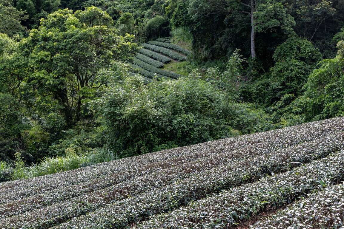
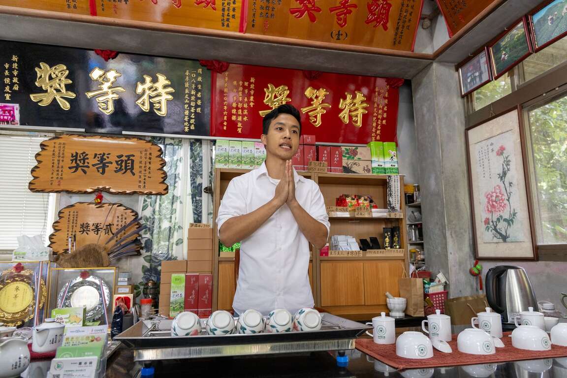
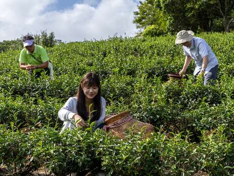
      The Bei Yi Highway is a 58-kilometer highway connecting Taipei and Yilan. The highway transportation function of the Bei Yi Highway replaced the traditional traffic route – Tamsui- Kavalan Historical and Cultural Trails, and has formed many new settlements. The latest traffic route brought traffic and people and allowed many industries to move to the side of the highway. Wang Lai Tea, which focuses on tea cultivation, is among the best. In the tea house full of unique award plaques, enjoy the excellent tea brewed by the tea garden owner and quietly appreciate the beautiful tea garden scenery.
      旺萊茶園
      旺萊茶園
      旺萊茶園
      Previous
      Summer at the end of the Century, evolutions on the Banqiao railway
      The Banqiao Railway Station today is a massive station and a transport hub located in the Xinban Special District. However, do you still remember the old Banqiao Railway Station situated on the MRT Fuzhong Station today? In recent years, many cities in Taiwan are conducting railway grade separation, such as the Railway Underground Project in Kaohsiung, Tainan and Taoyuan, and the Elevated Railway Project in Taichung. The Taipei Railway Underground Project, the first railway section to be conducted underground, started back in 1983. This project, spanning 30 years, has drastically transformed the transportation system and city landscape in Taipei City. This has also affected Banqiao, the capital district in New Taipei City. Let us roam from Fuzhong to Xinban Special District, and feel the changes between new and old Banqiao.The Banqiao Broadcasting Station, a municipal historic site located at the MRT Fuzhong Station, was completed and opened in 1930. It was designed by Kuriyama Shunichi, the architect of Taipei Beimen Post Office, which was completed in the same year. With its horizontal elevation, the building is a representation of contemporary architecture. Besides, it is also the most iconic Japanese colonial building in the area. As a transmission facility for radio broadcasting, the broadcasting station could send waves as far as Minxiong in Chiayi County. It is an important historical site when it comes to Taiwan's broadcasting history.The Fuzhong Shopping Area, located at the old Banqiao Railway Station, was once the busiest district in Banqiao and the entertainment center for the local residents. From 1901 to 1999, Banqiao Railway Station was situated in today’s Fuzhong. Even though the station has been relocated, the wide variety of stores still make Fuzhong a special place. karaoke bars, eateries, restaurants, malls and clothing stores co-exist and prosper together, making it a nice place for shopping in Banqiao. Moreover, the Halloween party at the end of October is a spectacular annual event in the Fuzhong Shopping Area.Although the old Banqiao Railway Station is gone because of the Railway Underground Project, we can still see the remaining traces of the old Banqiao Railway Station at Fuzhong Shopping Area. In the first year of the 20th century, the route of the Taiwan Railway had changed from passing through the north of the Dahan River in Xinzhuang to the south of the Dahan River in Banqiao, which laid the foundation for Banqiao to become the capital district of New Taipei City. The Railway Underground Project, which operated at the end of the century, boosted local development once again.Fuzhong 15 is the first theme pavilion that combines film and animation art with a documentary auditorium in Taiwan. After many years of development and management, Fuzhong 15 has become an important venue for sharing stories, and has become an important cultural landmark in Banqiao. Come to Fuzhong 15 and let its spokespeople, “Brother One” and “Brother Five” lead you into a world of images!Walk Along Xianmin Boulevard, which was rebuilt from an old railway, toward the northeast, where the new Banqiao Railway Station 800 meters away has turned into a transport hub and a large shopping area. The 25-story new station attracts passengers from the HSR, TR, MRT Bannan Line, Circular Line, and Banqiao Bus Station. It is a true business center, connecting office buildings, malls, and hotels in series in this area with underground walkways and skywalks. It also created the richest skyline in Banqiao District.There are lots of skyscrapers in Xinban Special District. It is a great thing for people to be able to overlook the city on a higher floor. With a height of 140.5 meters, New Taipei City Hall makes use of its height advantage by setting a free observation floor for viewing on the 32nd floor. People can take the exclusive elevator straight up to the observation deck. There, they can look 360 degrees through the full-width window design and see Mount Guanyin, Tamsui River, and Taipei 101 all at once, not to mention that you can clearly see the skyscrapers in Banqiao and Banqiao station since they are much closer. From the old Banqiao Railway Station to Xinban Special District, you can experience the differences brought about by the changed railway in Banqiao.
      Next
      Tarcking back the refreshing Daluolan River in the Ataya tribe of Wulai
      Wulai stands as the most expansive and highest-altitude region within New Taipei City. It represents the sole mountain indigenous district in New Taipei City, primarily inhabited by the Atayal ethnic group. The name "Wulai" originates from the Atayal word "Ulay", signifying the presence of hot springs. Upon entering the North 107 Rural Highway from Wulai Scenic Bridge, you will encounter the idyllic Tranan Tribe, akin to a hidden paradise. Visitors can leisurely walk along the lifeline of the tribe, the Daluolan (Tranan) River, roll up their pants, and immerse themselves in the refreshing river waters to escape the summer heat.Located about a half-hour drive from Wulai Old Street, Tranan Tribe is the first settlement of the Atayal people migrating from Balong in Taoyuan to Wulai in New Taipei City. Situated within the Nanshi River Watershed Protection Area, this small yet beautiful tribe has deliberately avoided excessive development, allowing inhabitants of this region to preserve the most traditional Atayal lifestyle in Wulai. Within the tribe, one can observe characteristic wall paintings and sculptures portraying themes centered around Atayal culture and beliefs.The Daluolan River, known as the mother river of the Tranan Tribe, derives its name from the Atayal word “Tranan” and serves as one of the tributaries of the Nanshi River. A century ago, Atayal people from Balong crossed over the mountain range in search of hunting grounds. They discovered this area, abundant in water sources and fertile soil, and gradually relocated here. During the Japanese domination period, the authorities at the time constructed irrigation canals to channel the waters of the Daluolan River to the tribe for farming purposes. The valley of the Daluolan River is lush and verdant, with the river channel varying between narrow passages and wide expanses. With groups of Taiwan shovel-jaw carps (Onychostoma barbatulum) swimming in crystal-clear waters, it has an astonishingly picturesque scenery.Both banks of the Daluolan River are equipped with scenic trails. The northern bank features an ancient canal trail, while the southern bank hosts the recently established Xilong Trail. The ancient canal trail, also known as the "Fushan Maan Ancient Canal Trail", no longer serves its original irrigation function but continues to flow endlessly. Surrounded by the shade of lush trees, the trail is adorned with towering old trees on both sides and various ferns thriving along the way. The trail is also furnished with rest areas and the Butterfly Garden, offering visitors a beautiful view of butterflies fluttering during the summer.The Tranan Scenic Bridge stands out as the newest attraction in the tribe, connecting the Ancient Canal Trail and Xilong Trail to form a circular route. This steel-structured arched bridge gracefully spans over the Daluolan River. As visitors traverse its path, they're greeted by breathtaking views of the valley and distant mountain peaks. The harmonious fusion of the river and lush forests crafts an invigorating visual spectacle. Returning to the tribe via the Xilong Trail, travelers encounter two intersecting paths that lead to the Daluolan River. Here, guests have the chance to kick off their shoes, roll up their pants, and immerse themselves in the refreshing waters, offering sweet respite from the summer's warmth.While returning to Wulai Old Street via the North 107 Rural Highway, take a moment to gaze toward the right bank where the cable car station of Yun Hsien Resort lies. Here, you can relish the captivating view of the majestic Flying Fountain gracefully descending from the mountaintop. Also known as Yunxian Waterfall, the impressive 80-meter-high cascade stands as the largest waterfall in Northern Taiwan. Since the Japanese colonial period, it has been revered as 'the waterfall from the clouds,' remaining one of the most renowned landscapes in Wulai.After crossing the Wulai Tourist Bridge, turn right to enter the most bustling area of Wulai – Wulai Old Street. Indulging in aromatic indigenous cuisine is a delightful reward after hiking. All the shops along Wulai Old Street have similar signboards. Here, you can discover various indigenous cuisines and local specialties. For instance, rice dumplings, bamboo tube rice, makauy (Litsea cubeba) dishes, bird's-nest fern, shallot, BBQ wild boar meat, hot spring eggs, millet mochi, and more. Let’s relish these local delicacies and satisfy your taste buds!
      Read more
      Back to the top of page
      小客帶路